

Minnesota road map
Minnesota River Valley Scenic Byway map
The Minnesota River Valley Scenic Byway has been a National Scenic Byway since 2002, named for its historic qualities: about 241 miles in Minnesota. It meets 24 highways, among them US 12, US 14 and US 59. Towns along it: Mankato, North Mankato and New Ulm.
Open the map (PDF, US Letter)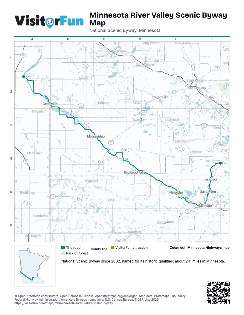
Highways it meets
Each highway it meets and the grid squares where they meet.
- MN 10A2
- MN 28A2
- MN 7A2
- MN 27A2
- US 12A2
- US 75B2
- MN 119B3
- MN 40B3
- US 59C3
- US 212C3
- MN 67C4
- MN 23C4
- US 71D4
- MN 19D4
- MN 4E5
- US 14E5
- MN 15E5
- MN 68E5
- MN 66F5
- US 169F5
- MN 60F5
- MN 22F5
- MN 99F5
- MN 93F5
Towns along the Minnesota River Valley Scenic Byway
In mile order, with the grid square of each.
- Browns Valleymile 1, A2
- Beardsleymile 8, A2
- Ortonvillemile 33, A2
- Odessamile 41, B2
- Louisburgmile 55, B3
- Watsonmile 80, C3
- Montevideomile 85, C3
- Granite Fallsmile 98, C4
- Redwood Fallsmile 134, D4
- Mortonmile 139, D4
- Franklinmile 144, D4
- New Ulmmile 169, E5
- Courtlandmile 180, E5
- North Mankatomile 198, F5
- Skylinemile 198, F5
- Mankatomile 199, F5
- Kasotamile 209, F5
- St. Petermile 210, F5
- Le Sueurmile 221, F5
- Hendersonmile 228, F4
- Belle Plainemile 239, F4
Things to do on the Minnesota River Valley Scenic Byway map
© OpenStreetMap contributors, Open Database License, openstreetmap.org/copyright · Map data: Protomaps · Boundary: Federal Highway Administration, America's Byways · Junctions: U.S. Census Bureau, TIGER/Line 2026