

Minnesota road map
Minnesota highway map
9 Interstate routes run about 896 miles in Minnesota, each on a sheet of its own. The sheet's index lists 52 highways; I-94, I-35 and I-90 cross the most grid squares. Towns on it: Minneapolis, Rochester and Duluth.
Open the map (PDF, US Letter)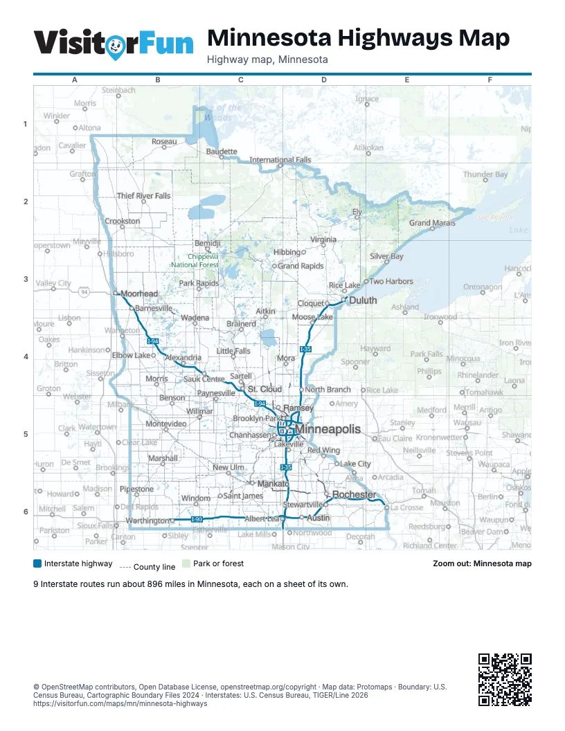
Road maps of Minnesota
15 road maps: each Interstate and byway on a sheet of its own.
- I-35 in Minnesota
- I-35E in Minnesota
- I-35W in Minnesota
- I-90 in Minnesota
- I-94 in Minnesota
- I-394 in Minnesota
- I-494 in Minnesota
- I-535 in Minnesota
- I-694 in Minnesota
- Edge of the Wilderness
- Grand Rounds Scenic Byway
- Historic Bluff Country Scenic Byway
- Minnesota River Valley Scenic Byway
- North Shore Scenic Drive
- Paul Bunyan Scenic Byway
Highway index of Minnesota
Each highway on the sheet and the grid squares it crosses.
- I-35D3, D4, D5, D6
- I-35ED5
- I-35WD5
- I-90B6, C6, D6, E6
- I-94A3, B3, B4, C4, C5, D5
- I-394C5, D5
- I-494C5, D5
- I-535D3
- I-694C5, D5
- US 2C3, D3
- US 8D5
- US 10B3, C4, C5, D5
- US 12C5, D5
- US 14C6, D6, E6
- US 52D5, D6
- US 53D3
- US 59B4
- US 61D5, E6
- US 63D6
- US 71C3, C5
- US 169C4, C5, C6
- US 212C5
- US 218D6
- MN 4C6
- MN 5C5, D5
- MN 7C5, D5
- MN 13C5, D5
- CH 15D5
- MN 15C4, C6
- MN 23B5, C5, D4
- MN 27B4
- MN 30C6
- MN 36D5
- MN 43D6
- MN 47C5, D5
- MN 51D5
- MN 55D5
- MN 56D6
- MN 60C6, D6
- MN 62C5, D5
- WI 64D5
- MN 65D4, D5
- MN 77D5
- MN 95D5
- MN 100D5
- MN 101C5
- MN 121D5
- MN 210B4
- MN 252D5
- MN 280D5
- MN 371C4
- MN 610C5, D5
Places on the map
- Aitkin
- Albert Lea
- Alexandria
- Austin
- Barnesville
- Baudette
- Bemidji
- Benson
- Brainerd
- Brooklyn Park
- Chanhassen
- Cloquet
- Crookston
- Duluth
- Elbow Lake
- Ely
- Grand Rapids
- Hibbing
- International Falls
- Lake City
- Lakeville
- Little Falls
- Mankato
- Marshall
- Minneapolis
- Montevideo
- Moorhead
- Moose Lake
- Mora
- Morris
- New Ulm
- North Branch
- Park Rapids
- Paynesville
- Pipestone
- Ramsey
- Red Wing
- Rice Lake
- Rochester
- Roseau
- Saint James
- Sartell
- Sauk Centre
- Silver Bay
- St. Cloud
- Stewartville
- Thief River Falls
- Two Harbors
- Virginia
- Wadena
- Willmar
- Windom
- Worthington
© OpenStreetMap contributors, Open Database License, openstreetmap.org/copyright · Map data: Protomaps · Boundary: U.S. Census Bureau, Cartographic Boundary Files 2024 · Interstates: U.S. Census Bureau, TIGER/Line 2026