

Illinois map
Springfield Metro Area map
The sheet's index lists 9 highways; I-55, I-72 and US 36 cross the most grid squares. Things to do inside the boundary: Abraham Lincoln Presidential Library and Museum, Lincoln Home National Historic Site and Lincoln Tomb. Also on it: Athens, Auburn and Berlin.
Open the map (PDF, US Letter)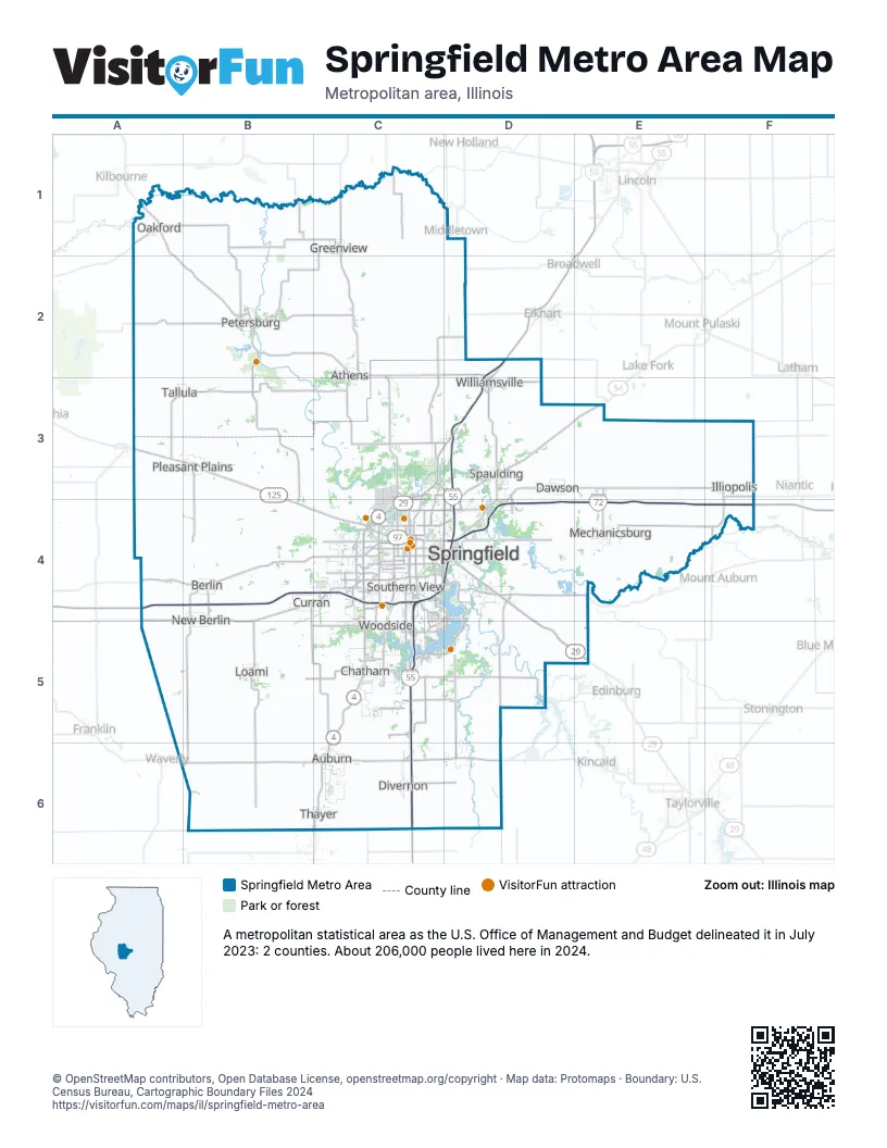
Highway index of Springfield Metro Area
Each highway on the sheet and the grid squares it crosses.
- I-55C3, C4, C5, C6, D2, D3, D4
- I-72A4, B4, C4, D4, E4, F4
- US 36A4, B4, C4, D4, E4, F4
- US 66C3, C4, C5, C6, D3
- IL 4C3, C4, C5, C6
- IL 29C3, C4, D4, D5, E5
- IL 54D3, D4, E3
- IL 97B4, C4
- IL 125A3, B3, B4
Things to do on the Springfield Metro Area map
- Abraham Lincoln Presidential Library and Museum
- Lincoln Home National Historic Site
- Lincoln Tomb
- Abraham Lincoln Memorial Garden
- Camp Butler National Cemetery
- Dana-Thomas House
- Kidzeum
- Knight's Action Park & Splash Kingdom
- Lincoln's New Salem State Historic Site
- Old State Capitol State Historic Site
- Union Square Park
Places on the map
- Athens
- Auburn
- Berlin
- Chatham
- Curran
- Dawson
- Divernon
- Greenview
- Illiopolis
- Loami
- Mechanicsburg
- New Berlin
- Oakford
- Petersburg
- Pleasant Plains
- Southern View
- Spaulding
- Springfield
- Tallula
- Thayer
- Williamsville
- Woodside
© OpenStreetMap contributors, Open Database License, openstreetmap.org/copyright · Map data: Protomaps · Boundary: U.S. Census Bureau, Cartographic Boundary Files 2024