

Arizona road map
Arizona highway map
6 Interstate routes run about 1,149 miles in Arizona, each on a sheet of its own. The sheet's index lists 23 highways; I-10, I-40 and I-8 cross the most grid squares. Towns on it: Phoenix, Tucson and Mesa.
Open the map (PDF, US Letter)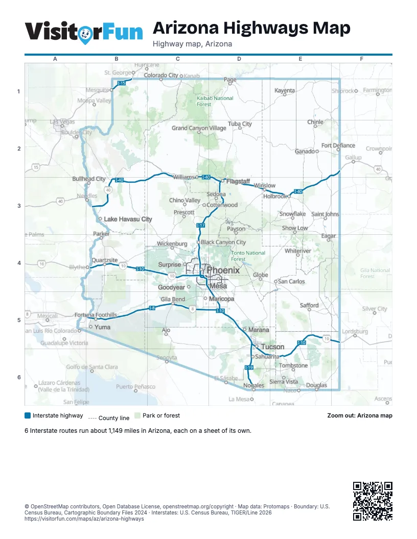
Road maps of Arizona
9 road maps: each Interstate and byway on a sheet of its own.
Highway index of Arizona
Each highway on the sheet and the grid squares it crosses.
- I-8B5, C5, D5
- I-10B4, C4, D4, D5, D6, E5, E6, F5
- I-15B1
- I-17C3, C4, D3
- I-19D5, D6
- I-40B3, C2, C3, D2, D3, E2, E3, F2
- US 60C4, D4
- US 66B3
- US 80D4
- US 93A2, B3
- US 95B4
- US 180D3, E3
- US 191E3, E5
- AZ 24D4
- AZ 51C4
- AZ 69C3
- AZ 77E3
- AZ 89AC3, D3
- AZ 99D3
- AZ 101C4, D4
- AZ 143C4
- AZ 202C4, D4
- AZ 303C4
Places on the map
- Ajo
- Black Canyon City
- Bullhead City
- Chinle
- Chino Valley
- Colorado City
- Cottonwood
- Douglas
- Eagar
- Flagstaff
- Fort Defiance
- Fortuna Foothills
- Ganado
- Gila Bend
- Globe
- Goodyear
- Grand Canyon Village
- Holbrook
- Kayenta
- Lake Havasu City
- Marana
- Maricopa
- Mesa
- Nogales
- Page
- Parker
- Payson
- Phoenix
- Prescott
- Quartzsite
- Safford
- Sahuarita
- Saint Johns
- San Carlos
- Sedona
- Show Low
- Sierra Vista
- Snowflake
- Surprise
- Tombstone
- Tuba City
- Tucson
- Whiteriver
- Wickenburg
- Williams
- Winslow
- Yuma
© OpenStreetMap contributors, Open Database License, openstreetmap.org/copyright · Map data: Protomaps · Boundary: U.S. Census Bureau, Cartographic Boundary Files 2024 · Interstates: U.S. Census Bureau, TIGER/Line 2026















