

Florida map
Osceola County map
About 468,058 people live here (Census Bureau, 2024 estimate). The sheet's index lists 8 streets; Florida's Turnpike, Western Beltway and North World Drive cross the most grid squares. Also on it: 16 holes, Ajay Lake and Alligator Lake.
Open the map (PDF, US Letter)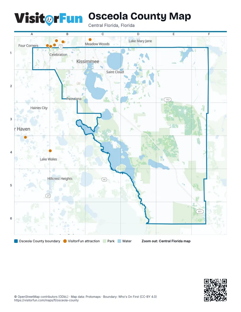
Street index of Osceola County
Each street on the sheet and the grid squares it crosses.
- Western BeltwayA1
- North World DriveB1
- Southern Connector ExtensionB1
- West Irlo Bronson Memorial HighwayB1
- West Osceola ParkwayB1
- World DriveB1
- Florida's TurnpikeC1, C2, C3, D3, D4, E4, E5, F6
- Poinciana ParkwayB2
Places on the map
- 16 holes
- Ajay Lake
- Alligator Lake
- Athena's Meadow
- Bay Lake
- Bee Ponds
- Bee Tree Swamp
- Big Bend Swamp
- Brick Lake
- Brown Lake
- Buck Lake
- Buenaventura Lakes
- Bull Creek Swamp
- Cabbage Slough Swamp
- Camp Lonesome Conservation Area
- Campbell
- Cane Island Power Park
- Cat Island Swamp
- Cat Lake
- Celebration Golf Club
- Center Lake Slough
- Clay Hole Pond
- Coon Lake
- Countryside
- Crabgrass Creek Swamp
- Cypress Lake
- Davenport Creek Swamp
- Deluca Preserve
- Deseret Ranches
- Devils Elbow Swamp
- Disney Wilderness Preserve
- Doral Point
- Doral Woods
- Drawdy Bay
- Eagle Pond
- East Lake Park
- East Lake Reserve
- East Lake Tohopekaliga
- Econlockhatchee River Swamp
- Encore
Next to Osceola County
- Four Corners
- Haines City
- Hillcrest Heights
- Hunters Creek
- Lake Hart
- Lake Mary Jane
- Lake Wales
- Meadow Woods
- Poinciana
- Winter Haven
© OpenStreetMap contributors (ODbL) · Map data: Protomaps · Boundary: Who's On First (CC-BY 4.0)