

Georgia map
Henry County map
About 259,315 people live here (Census Bureau, 2024 estimate). The sheet's index lists 56 streets; Highway 81 East, I-75 South Metro Express Lanes and Highway 155 North cross the most grid squares. Things to do inside the boundary: McDonough.
Open the map (PDF, US Letter)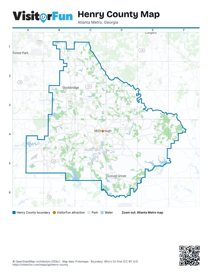
Street index of Henry County
Each street on the sheet and the grid squares it crosses.
- Anvil Block RoadB1
- Fairview RoadB1, C1
- Snapfinger RoadC1, C2
- I-75 South Metro Express LanesB2, B3, C3, C4
- Lake Spivey ParkwayB2
- Macon HighwayB2
- North Henry BoulevardB2, C2, C3
- Terrell Starr ParkwayB2, B3
- Highway 155 NorthC2, D2, C3, C4
- Old Conyers RoadC2
- Steam Mill ExpresswayC2
- Airline RoadD2, D3
- Kelleytown RoadD2, D3
- Eagles Landing ParkwayB3, C3
- Hudson Bridge RoadB3
- Jodeco RoadB3, C3
- Campground RoadC3
- East Lake ParkwayC3
- State Route 42C3
- Conyers RoadD3, E3, D4
- Highway 81 EastF3, C4, D4, E4, F4
- Highway 81 SouthF3
- Keys RoadF3, F4
- Hastings Bridge RoadB4
- Jonesboro RoadB4, C4
- McDonough-Lovejoy RoadB4, C4
- Old Highway 3B4, B5
- Atlanta StreetC4
- East Greenwood RoadC4
- GA 155C4
- Geranium DriveC4
- Griffin StreetC4
- Hampton RoadC4, C5
- Hampton StreetC4
- Hazelhurst StreetC4
- John Frank Ward BoulevardC4, D4
- Jonesboro StreetC4
- Keys Ferry StreetC4
- Macon StreetC4, C5
- McDonough RoadC4, C5
- McDonugh-Lovejoy RoadC4
- North Zack Hinton ParkwayC4, D4
- Sims StreetC4
- South Zack Hinton ParkwayC4
- Bear Creek BoulevardA5, B5
- East Main Street NorthB5
- East Main Street SouthB5
- Lower Woolsey RoadB5
- McDonough StreetB5
- McDonough-Hampton RoadB5, C5
- Old Griffin RoadB5
- Old State Route 3B5
- Rosenwald DriveB5
- West Main StreetB5
- Woodlawn AvenueB5
- Woolsey RoadB5
Things to do on the Henry County map
Places on the map
- Alexander Park West
- Alhambra Circle
- Annaberg
- Aspen Woods
- Atlanta South RV Park
- Aylo Health - Primary Care at McDonough, Hwy 155
- Belk-Elrod Lake
- Berry Hill Airport
- Blalock Resoirvoir
- Bowers Farm
- Boyds Lake
- Bud Kelley Park
- Cattlemans Circle
- Clayton County Reservoir
- Clover Ranch Mobile Home Park
- Club Lake
- Cole Resorvoir
- Colton Creek Apartments
- Cotton Fields Golf Course
- Crown Manor
- Crystal Lake
- Crystal Lake Golf & Country Club
- Duggan Lake
- Eagle's Landing Country Club
- Eagle's Landing High School
- EchoPark Speedway
- Edinburgh
- Everleigh
- Fairview Memorial Gardens
- Farris Park
- Fausel Lake
- Fears Mill
- Fortson 4-H Center
- Garden Lakes
- Georgia National Country Club
- Green Valley Lake
- Greystone Manor
- Hampton
- Hardeman Lake
Next to Henry County
- Conyers
- Forest Park
© OpenStreetMap contributors (ODbL) · Map data: Protomaps · Boundary: Who's On First (CC-BY 4.0)