

Massachusetts map
Springfield Metro Area map
The sheet's index lists 10 highways; I-90, I-91 and I-391 cross the most grid squares. Things to do inside the boundary: Brimfield State Forest, Canna Provisions and Holyoke Mall. Also on it: Chicopee, East Longmeadow and Holyoke.
Open the map (PDF, US Letter)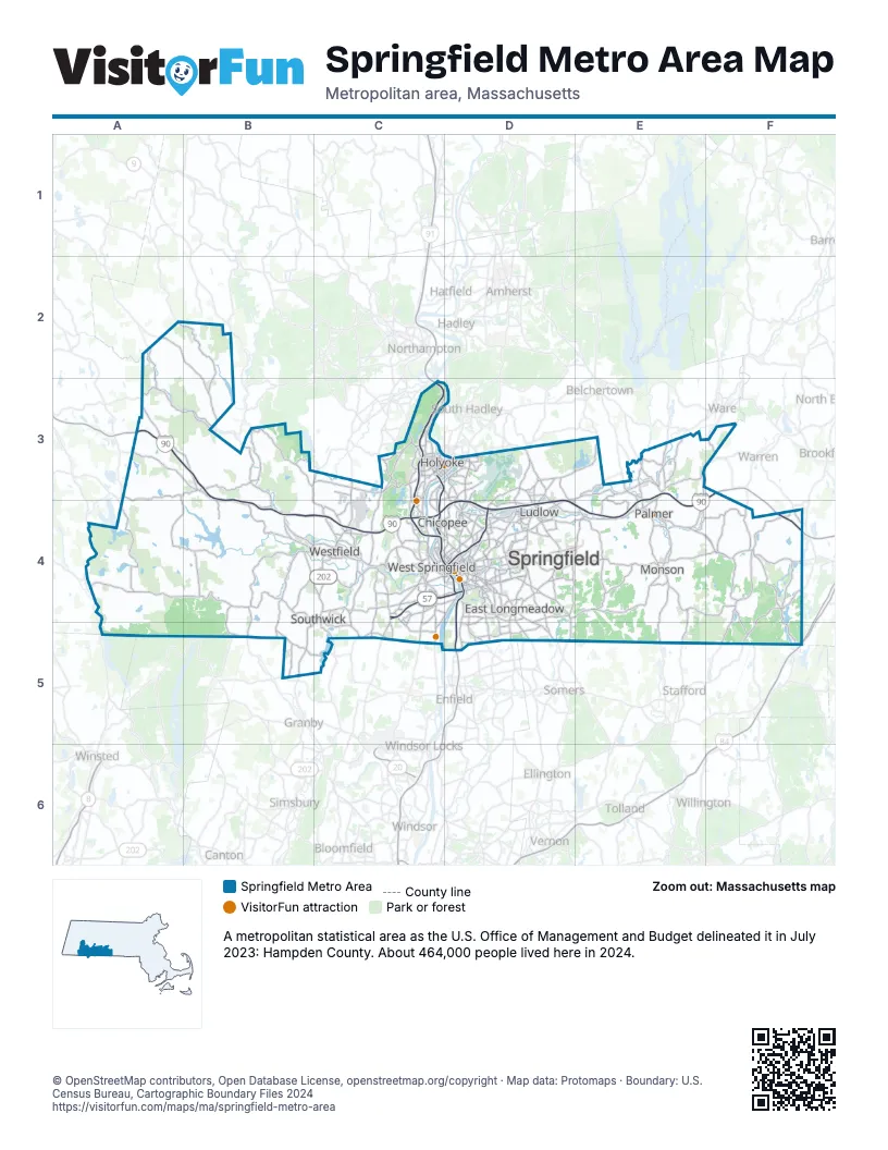
Highway index of Springfield Metro Area
Each highway on the sheet and the grid squares it crosses.
- I-90A3, B3, B4, C4, D4, E3, E4, F3, F4
- I-91C3, C4, D4, D5
- I-291D4
- I-391C3, C4
- US 5C4, D4
- US 20C4, D4
- US 202B5, C4
- CT 10B5
- MA 10B5, C4
- MA 57C4, D4
Things to do on the Springfield Metro Area map
- Brimfield State Forest
- Holyoke Mall
- International Volleyball Hall of Fame
- Lyman and Merrie Wood Museum of Springfield History
- MGM Springfield
- Naismith Basketball Hall of Fame
- Robinson State Park
- Sheraton Springfield Monarch Place Hotel
- Six Flags New England
- Springfield Armory National Historic Site
- Stanley Park of Westfield
- Trainmaster's Inn
Places on the map
- Chicopee
- East Longmeadow
- Holyoke
- Ludlow
- Monson
- Palmer
- Southwick
- Springfield
- West Springfield
- Westfield
© OpenStreetMap contributors, Open Database License, openstreetmap.org/copyright · Map data: Protomaps · Boundary: U.S. Census Bureau, Cartographic Boundary Files 2024