

Massachusetts map
Worcester Metro Area map
The sheet's index lists 18 highways; MA 9, I-90 and I-495 cross the most grid squares. Things to do inside the boundary: Bigelow Monument, Fitchburg Art Museum and Icon Museum and Study Center. Also on it: Ashburnham, Athol and Auburn.
Open the map (PDF, US Letter)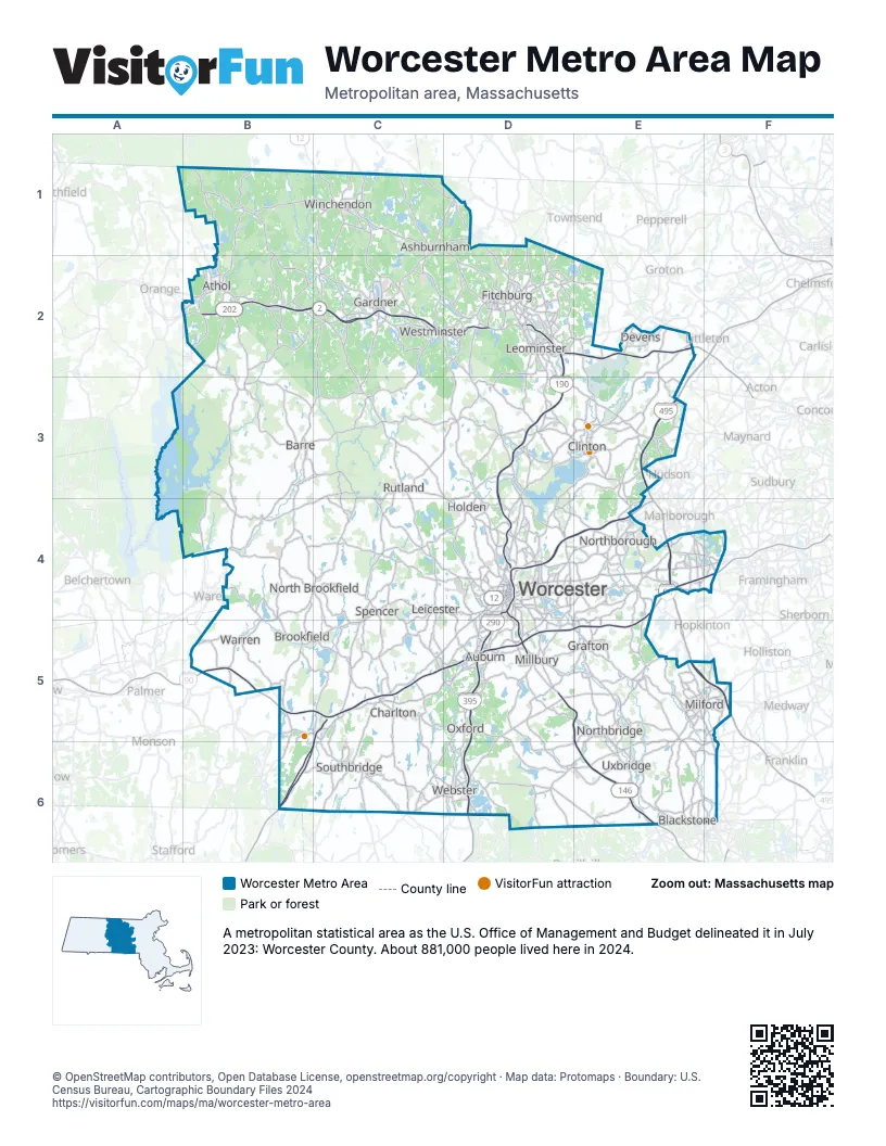
Highway index of Worcester Metro Area
Each highway on the sheet and the grid squares it crosses.
- I-84B6, C5, C6
- I-90B5, C5, D5, E4, E5, F4
- I-190D2, D3, D4
- I-290D4, D5, E4
- I-395D5, D6
- I-495E3, E4, E5, F5
- US 202B2, C1
- MA 2B2, C2, D2, E2
- MA 2AC2, D2
- MA 9B4, B5, C4, C5, D4, E4, F4
- MA 12C1, D2, D4
- MA 31C4, D2
- MA 67B4, B5
- MA 70D4
- MA 122D4, D5
- MA 122AD4, D5
- MA 140C1, C2, D2
- MA 146D4, D5, E5, E6
Things to do on the Worcester Metro Area map
Places on the map
- Ashburnham
- Athol
- Auburn
- Barre
- Blackstone
- Brookfield
- Charlton
- Clinton
- Devens
- Fitchburg
- Gardner
- Grafton
- Holden
- Leicester
- Leominster
- Milford
- Millbury
- North Brookfield
- Northborough
- Northbridge
- Oxford
- Rutland
- Southbridge
- Spencer
- Uxbridge
- Warren
- Webster
- Westminster
- Winchendon
- Worcester
© OpenStreetMap contributors, Open Database License, openstreetmap.org/copyright · Map data: Protomaps · Boundary: U.S. Census Bureau, Cartographic Boundary Files 2024