

Maryland road map
Chesapeake Country Scenic Byway map
The Chesapeake Country Scenic Byway has been an All-American Road since 2021, named for its cultural and recreational qualities: about 84 miles in Maryland. It meets 30 highways, among them US 50, US 301 and MD 18. Towns along it: Chestertown, Centreville and Rock Hall.
Open the map (PDF, US Letter)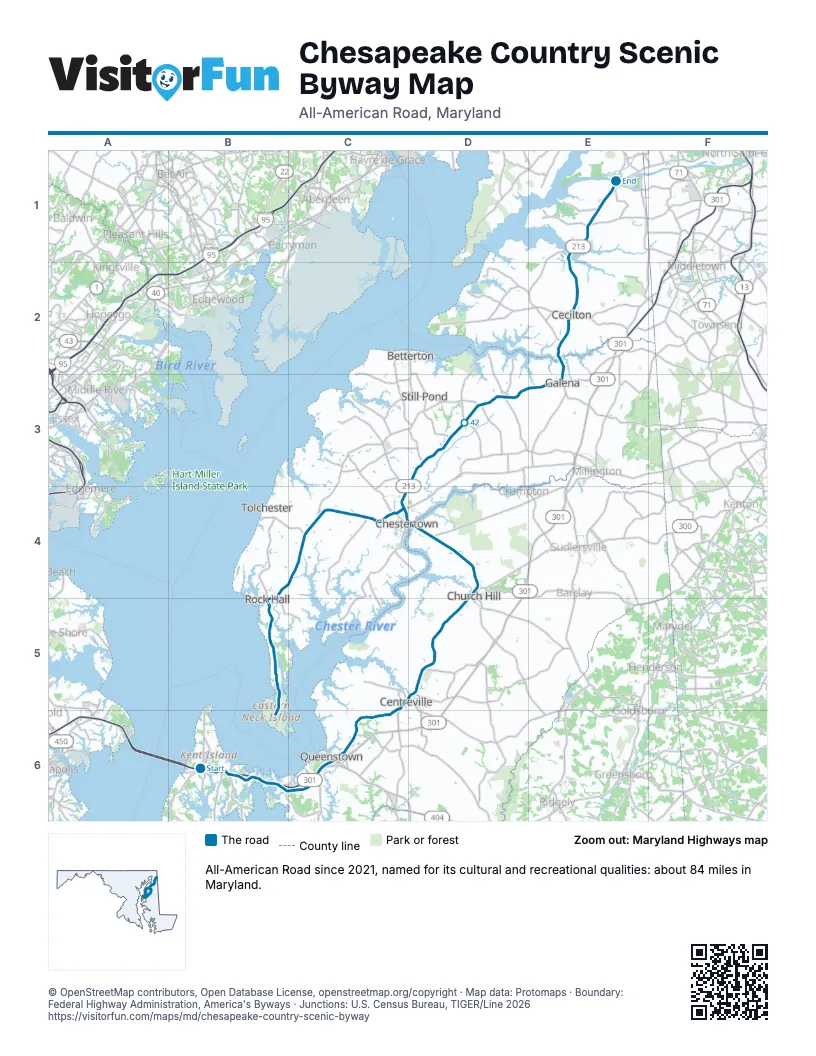
Highways it meets
Each highway it meets and the grid squares where they meet.
- MD 759B6
- MD 18B6
- US 50B6
- US 301B6
- MD 552B6
- MD 835B6
- MD 656C6
- MD 456C6
- MD 213C5
- MD 304C5
- MD 305D5
- MD 300D4
- MD 19D4
- MD 544D4
- MD 289D4
- MD 291C4
- MD 297C4
- MD 561D3
- MD 298D3
- MD 444D3
- MD 282E2
- MD 310E1
- MD 286E1
- MD 342E1
- MD 514E1
- MD 20E1
- MD 446C4
- MD 21C4
- MD 288B4
- MD 445B5
Towns along the Chesapeake Country Scenic Byway
In mile order, with the grid square of each.
- Stevensvillemile 0, B6
- Chestermile 1, B6
- Kent Narrowsmile 4, B6
- Grasonvillemile 6, B6
- Queenstownmile 10, C6
- Centrevillemile 16, C6
- Church Hillmile 26, D4
- Kingstownmile 32, D4
- Chestertownmile 33, D4
- Kennedyvillemile 42, D3
- Ceciltonmile 53, E2
- Chesapeake Citymile 63, E1
- Fairleemile 67, C4
- Georgetownmile 69, C4
- Edesvillemile 74, C4
- Rock Hallmile 76, B5
© OpenStreetMap contributors, Open Database License, openstreetmap.org/copyright · Map data: Protomaps · Boundary: Federal Highway Administration, America's Byways · Junctions: U.S. Census Bureau, TIGER/Line 2026















