

Maine road map
Bold Coast Scenic Byway map
The Bold Coast Scenic Byway has been a National Scenic Byway since 2021, named for its historic qualities: about 139 miles in Maine. It meets 10 highways, among them US 1, ME 9 and ME 86. Towns along it: Calais, Machias and Milbridge.
Open the map (PDF, US Letter)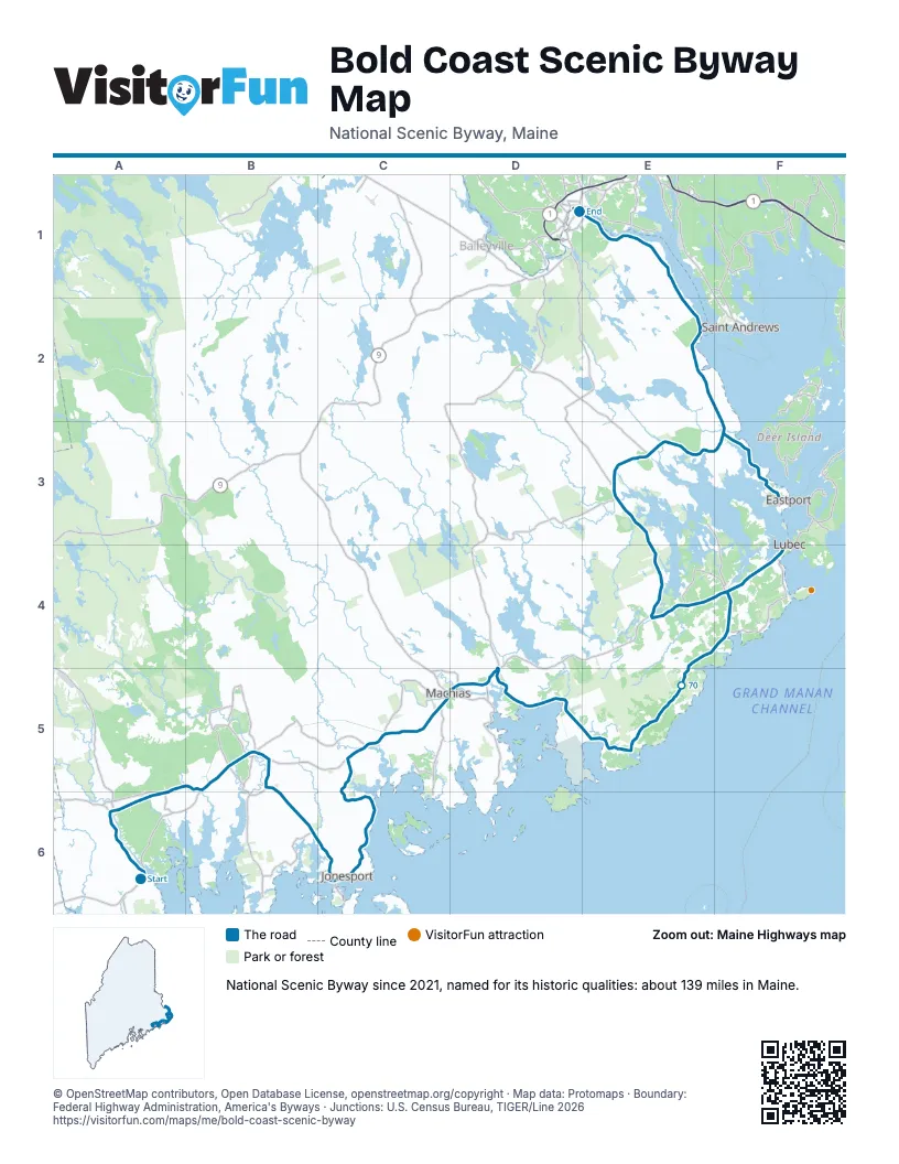
Highways it meets
Each highway it meets and the grid squares where they meet.
- US 1A6
- ME 187B5
- ME 92C5
- ME 192D5
- ME 191D5
- ME 189E4
- ME 86E3
- ME 214E3
- ME 190F3
- ME 9E1
Towns along the Bold Coast Scenic Byway
In mile order, with the grid square of each.
- Milbridgemile 0, A6
- Steubenmile 0, A6
- Cherryfieldmile 2, A6
- Harringtonmile 8, A6
- Columbiamile 9, A6
- Addisonmile 14, B5
- Columbia Fallsmile 16, B5
- Jonesportmile 24, B6
- Bealsmile 29, C6
- Jonesboromile 35, C6
- Whitneyvillemile 44, C5
- Machiasmile 45, C5
- Marshfieldmile 49, D5
- East Machiasmile 50, D5
- Machiasportmile 51, D5
- Whitingmile 56, D5
- Cutlermile 57, D5
- East Central Washingtonmile 69, E5
- Lubecmile 76, F4
- Dennysvillemile 91, E3
- Pembrokemile 92, E3
- Perrymile 98, E3
- Robbinstonmile 108, E2
- Calaismile 115, E1
- Passamaquoddy Pleasant Pointmile 125, F3
- Eastportmile 127, F3
© OpenStreetMap contributors, Open Database License, openstreetmap.org/copyright · Map data: Protomaps · Boundary: Federal Highway Administration, America's Byways · Junctions: U.S. Census Bureau, TIGER/Line 2026















