

Maine road map
St. John Valley Cultural Byway/Fish River Scenic Byway map
The St. John Valley Cultural Byway/Fish River Scenic Byway has been a National Scenic Byway since 2021, named for its cultural qualities: about 102 miles in Maine. It meets 5 highways, among them US 1, US 1A and ME 161. Towns along it: Fort Kent, Madawaska and Van Buren.
Open the map (PDF, US Letter)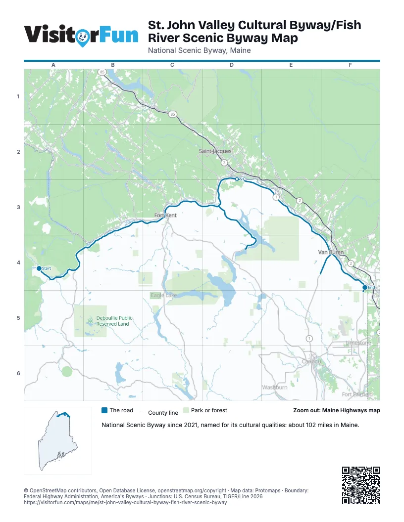
Highways it meets
Each highway it meets and the grid squares where they meet.
- ME 161A4
- US 1C3
- US 1AF4
- ME 165F4
- ME 162D4
Towns along the St. John Valley Cultural Byway/Fish River Scenic Byway
In mile order, with the grid square of each.
- Allagashmile 0, A4
- Northwest Aroostookmile 7, A4
- St. Francismile 8, A4
- St. Johnmile 18, B4
- Fort Kentmile 25, B3
- Frenchvillemile 38, C3
- Madawaskamile 47, D3
- Grand Islemile 58, E3
- Van Burenmile 66, E3
- Hamlinmile 76, F4
- Cyrmile 77, F4
- Square Lakemile 90, D4
- St. Agathamile 93, D4
© OpenStreetMap contributors, Open Database License, openstreetmap.org/copyright · Map data: Protomaps · Boundary: Federal Highway Administration, America's Byways · Junctions: U.S. Census Bureau, TIGER/Line 2026















