

Michigan map
Macomb County map
About 886,175 people live here (Census Bureau, 2024 estimate). The sheet's index lists 13 streets; Ford Freeway, Christopher Columbus Freeway and Edsel Ford Freeway cross the most grid squares. Also on it: Amherst, Anchor Bay and Anchor Bay Harbor.
Open the map (PDF, US Letter)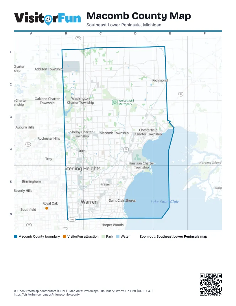
Street index of Macomb County
Each street on the sheet and the grid squares it crosses.
- Christopher Columbus FreewayC3, C4
- Ford FreewayD3, E3, D4, C5, D5
- Edsel Ford FreewayC5, C6
- I-696 EastB6
- I-696 East to Northbound Mound RoadB6
- I-696 East to Southbound Mound RoadB6
- I-696 West to Northbound Mound RoadB6
- I-696 West to Southbound Mound RoadB6
- Northbound Mound Road to I-696 EastB6
- Northbound Mound Road to I-696 WestB6
- Southbound Mound Road to I-696 EastB6
- Southbound Mound Road to I-696 WestB6
- Walter P Reuther FreewayB6, C6
Places on the map
- Amherst
- Anchor Bay
- Anchor Bay Harbor
- Anchor Bay Shores
- Anchor Bay Woods Preserve
- Applewood Valley
- Armada
- Armada Township
- Ashley Farms
- Aspen Creek Apartments
- Autumn Creek
- Balmoral Park
- Bannister Lakes
- Barclay Estates
- Baroness Estates
- Baycourt Estates
- Beacon Pointe
- Beacon Square
- Bertha M. Pollard Park
- Bethesda Church
- Biltmore Park
- Birchgrove
- Black Creek
- Blake's Orchard Cider Mill
- Bradbury
- Breckenridge Village
- Brentwood Farms
- Briar Towne
- Bridgewood Estates
- Broad Acres
- Brookside Estates
- Brookside Manor
- Bruce Hills Golf Course
- Bruce Township
- Buckingham Glen
- Buckingham Village
- Buckingham Woods
- Camelot Villa
- Capri Villa
- Carriage Hills
Next to Macomb County
- Addison Township
- Auburn Hills
- Beverly Hills
- Birmingham
- Clawson
- Grosse Pointe Shores
- Harper Woods
- Madison Heights
- Oakland Charter Township
- Orion Charter Township
- Rochester
- Rochester Hills
- Royal Oak
- Southfield
- Troy
© OpenStreetMap contributors (ODbL) · Map data: Protomaps · Boundary: Who's On First (CC-BY 4.0)