

Montana road map
Montana highway map
3 Interstate routes run about 1,164 miles in Montana, each on a sheet of its own. The sheet's index lists 14 highways; I-90, I-15 and I-94 cross the most grid squares. Towns on it: Billings, Missoula and Great Falls.
Open the map (PDF, US Letter)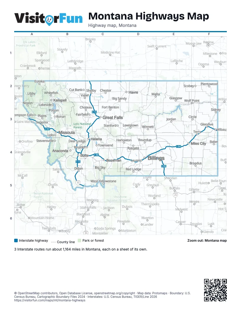
Road maps of Montana
3 road maps: each Interstate and byway on a sheet of its own.
Highway index of Montana
Each highway on the sheet and the grid squares it crosses.
- I-15B4, B5, C2, C3, C4
- I-90A3, B3, B4, C4, D4, E4, E5
- I-94D4, E4, F3, F4
- I-115B4
- I-315C3
- US 12B3, B4, E4
- US 87D4, E4, E5
- US 89C3, C4
- US 93B3
- US 191C4, D4
- US 212D4, E4
- US 287C3, C4
- MT 3C3
- MT 200B3, C3
Places on the map
- Anaconda
- Baker
- Big Sandy
- Big Sky
- Billings
- Boulder
- Bozeman
- Broadus
- Butte
- Chester
- Choteau
- Circle
- Cut Bank
- Deer Lodge
- Dillon
- Eureka
- Fairfield
- Fort Benton
- Glasgow
- Glendive
- Great Falls
- Harlowton
- Havre
- Helena
- Jordan
- Kalispell
- Lakeside
- Laurel
- Lewistown
- Libby
- Lolo
- Malta
- Miles City
- Missoula
- Noxon
- Plains
- Plentywood
- Polson
- Red Lodge
- Ronan
- Roundup
- Ryegate
- Scobey
- Shelby
- Sidney
- Stanford
- Stevensville
- Superior
- Terry
- Thompson Falls
- Townsend
- Valier
- West Yellowstone
- Whitefish
- Wibaux
- Winnett
- Wolf Point
© OpenStreetMap contributors, Open Database License, openstreetmap.org/copyright · Map data: Protomaps · Boundary: U.S. Census Bureau, Cartographic Boundary Files 2024 · Interstates: U.S. Census Bureau, TIGER/Line 2026