

Nebraska map
Grand Island Metro Area map
The sheet's index lists 5 highways; I-80, US 30 and US 281 cross the most grid squares. Things to do inside the boundary: Stuhr Museum of the Prairie Pioneer. Also on it: Central City, Grand Island and Saint Paul.
Open the map (PDF, US Letter)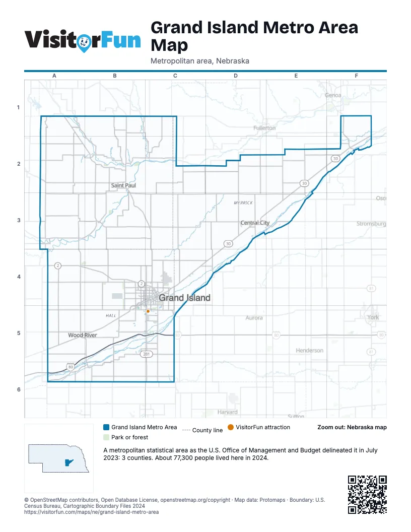
Highway index of Grand Island Metro Area
Each highway on the sheet and the grid squares it crosses.
- I-80A5, A6, B4, B5, C4, C5
- US 30C4, D3, D4, E2, E3, F2
- US 30RC4
- US 34C5, C6
- US 281B4, C4, C5, C6
Things to do on the Grand Island Metro Area map
Places on the map
- Central City
- Grand Island
- Saint Paul
- Wood River
© OpenStreetMap contributors, Open Database License, openstreetmap.org/copyright · Map data: Protomaps · Boundary: U.S. Census Bureau, Cartographic Boundary Files 2024