

Tennessee road map
Cumberland Historic Byway map
The Cumberland Historic Byway has been a National Scenic Byway since 2021, named for its historic qualities: about 158 miles in Tennessee. It meets 19 highways, among them I-75, US 25W and US 27. Towns along it: La Follette, Harrogate and Livingston.
Open the map (PDF, US Letter)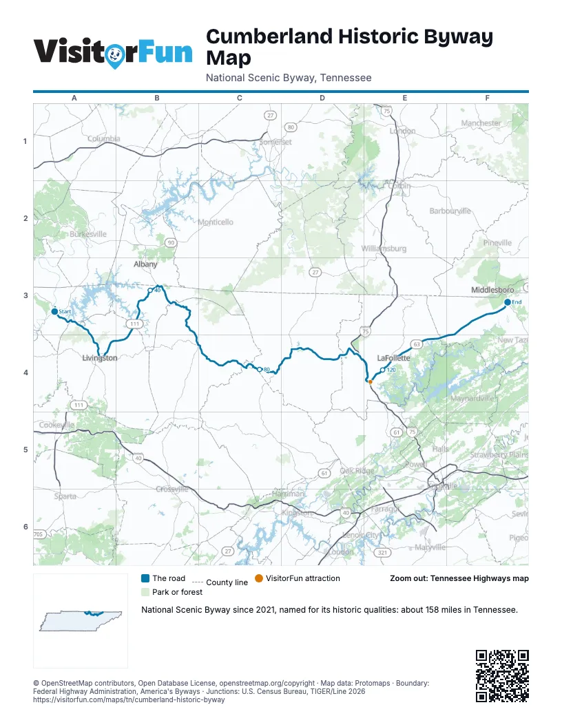
Highways it meets
Each highway it meets and the grid squares where they meet.
- TN 52A3
- TN 53A3
- TN 136A3
- TN 111A4
- TN 42A4
- TN 294A4
- TN 325B3
- TN 295B3
- US 127B3
- TN 28B3
- TN 154B4
- US 27C4
- TN 29C4
- TN 63D4
- TN 297D4
- TN 456D4
- I-75E4
- US 25WE4
- TN 9E4
Towns along the Cumberland Historic Byway
In mile order, with the grid square of each.
- Celinamile 0, A3
- Livingstonmile 16, A4
- Byrdstownmile 37, B3
- Jamestownmile 59, B4
- Allardtmile 65, C4
- Elginmile 83, C4
- Robbinsmile 85, C4
- Huntsvillemile 90, D4
- Helenwoodmile 91, D4
- Caryvillemile 110, D4
- Jacksboromile 116, E4
- La Follettemile 119, E4
- Fincastlemile 128, E4
- Harrogatemile 155, F3
Things to do on the Cumberland Historic Byway map
© OpenStreetMap contributors, Open Database License, openstreetmap.org/copyright · Map data: Protomaps · Boundary: Federal Highway Administration, America's Byways · Junctions: U.S. Census Bureau, TIGER/Line 2026