

Tennessee map
Knoxville Metro Area map
The sheet's index lists 37 highways; I-75, US 25W and I-40 cross the most grid squares. Things to do inside the boundary: American Museum of Science and Energy, Cades Cove and Children's Museum of Oak Ridge. Also on it: Clinton, Farragut and Halls.
Open the map (PDF, US Letter)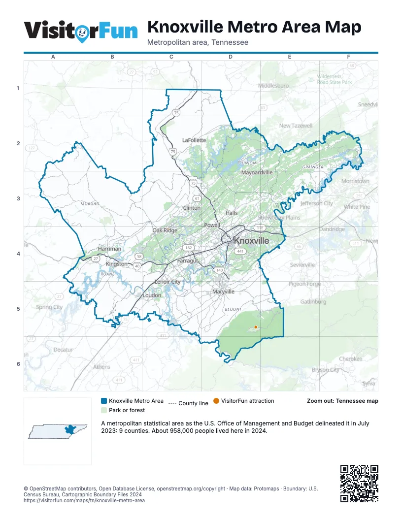
Highway index of Knoxville Metro Area
Each highway on the sheet and the grid squares it crosses.
- I-40A4, B4, C4, D4, E4
- I-75B5, C1, C2, C3, C4, C5, D3, D4
- I-140C4, D4
- I-275D4
- I-640D3, D4
- US 11D4
- US 11ED4, E3, E4
- US 11WD3, D4, E2, E3, F2
- US 25EF2
- US 25WC2, C3, C4, D3, D4, E4
- US 27A4, A5, B2, B3, B4
- US 70A4, B4, D4, E4
- US 129D4, D5
- US 321C4, C5, D5, E5
- US 411C5, D5
- US 441D4
- SR 1E2, E3, F2
- SR 32F2
- SR 33D4
- SR 58B4, C4
- SR 61B4, C3, C4
- TN 61C3, D3
- SR 62B3, C3, C4
- TN 62C4
- SR 63C2, D2
- TN 63C2
- TN 71D4
- SR 72C5
- TN 95C3, C4
- TN 115D4, D5
- SR 131D4
- TN 158D4
- SR 162C4
- TN 162C4, D4
- SR 299A4
- TN 326B4
- SR 335D5
Things to do on the Knoxville Metro Area map
Places on the map
- Clinton
- Farragut
- Halls
- Harriman
- Kingston
- Knoxville
- LaFollette
- Lenoir City
- Loudon
- Maryville
- Maynardville
- Oak Ridge
- Powell
© OpenStreetMap contributors, Open Database License, openstreetmap.org/copyright · Map data: Protomaps · Boundary: U.S. Census Bureau, Cartographic Boundary Files 2024