

Tennessee map
Williamson County map
About 269,136 people live here (Census Bureau, 2024 estimate). The sheet's index lists 71 streets; Tennessee National Guard Parkway, Natchez Trace Parkway and Franklin Road cross the most grid squares. Also on it: Andover, Annecy and Arlington Heights.
Open the map (PDF, US Letter)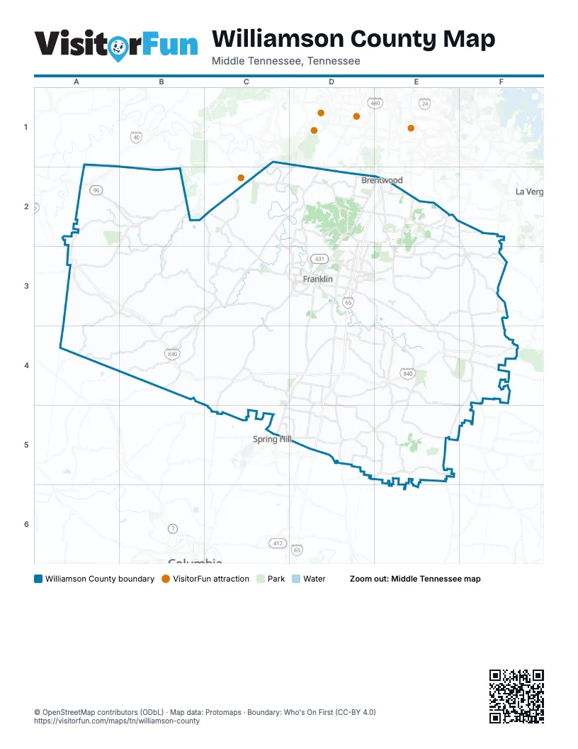
Street index of Williamson County
Each street on the sheet and the grid squares it crosses.
- Fairview BoulevardA2, B2, A3
- Highway 96A2
- Fairview Boulevard EastB2
- Natchez Trace ParkwayC2, B3, C3, B4
- Old Hillsboro RoadC2, D2, C3
- State Highway 96C2, C3, D3
- Carothers ParkwayD2, D3, D4
- Concord RoadD2, E2
- Franklin RoadD2, E2, D3, F4
- Granny White PikeD2
- Hillsboro RoadD2, D3
- I 65D2, E2, D3
- Lynnwood WayD2
- Mallory LaneD2, D3
- Maryland WayD2, E2
- Moores LaneD2, E2
- Murray LaneD2
- South Berrys Chapel RoadD2
- Burkitt RoadE2
- Church Street EastE2
- Crockett RoadE2
- Edmondson PikeE2
- Nolensville PikeE2
- Nolensville RoadE2, F2, F3, F4
- Ragsdale RoadE2, E3
- Raintree ParkwayE2, E3
- Sunset RoadE2
- Wilson PikeE2, E3, E4
- Pinewood RoadA3, B3, C3
- State Highway 100A3
- Tennessee National Guard ParkwayA3, B3, B4, C4, D4, E4, F4
- Carters Creek PikeC3, D3, C4, C5
- Leipers Creek RoadC3
- Mack C Hatcher Memorial ParkwayC3, D3
- 3rd Avenue NorthD3
- 3rd Avenue SouthD3
- 5th Avenue NorthD3
- 5th Avenue SouthD3
- 7th Avenue SouthD3
- Century CourtD3
- Church StreetD3
- Columbia AvenueD3
- Columbia PikeD3, C4, D4, C5
- Cool Springs BoulevardD3
- East Main StreetD3
- East McEwen DriveD3, E3
- Lewisburg AvenueD3, D4
- Lewisburg PikeD3, D4, D5
- Main StreetD3, C5
- Murfreesboro RoadD3, E3, E4, F4
- Public SquareD3
- Royal Oaks BoulevardD3
- South Royal Oaks BoulevardD3
- West Main StreetD3
- West McEwen DriveD3
- Clovercroft RoadE3, F3
- Split Log RoadE3
- Rock Springs RoadF3
- Rocky Fork RoadF3
- Rocky Springs RoadF3
- Franklin and Lewisburg PikeD4
- Goose Creek BypassD4
- I-65D4, D5
- Peytonsville RoadD4
- Horton HighwayF4, E5, F5
- Shelbyville HighwayF4
- Shelbyville RoadF4
- Duplex RoadC5, D5
- Buckner LaneD5
- June Lake BoulevardD5
- New Port Royal RoadD5
Places on the map
- Andover
- Annecy
- Arlington Heights
- Arrington Vineyards
- Autumn Crest Farm
- Autumn Ridge
- Baker Springs
- Ballenger Farms
- Battle Ground Academy
- Beech Grove Farms
- Belshire
- Benevento
- Benevento East
- Berkshire Estates
- Bonbrook on Concord
- Bowie Nature Park
- Brenthaven
- Brenthaven East
- Brenthaven Place
- Brentmeade
- Brentwood
- Brentwood Academy
- Brentwood Baptist Church
- Brentwood Country Club
- Brentwood Meadows
- Bridgeton Park
- Brookfield
- Buckingham Park
- Butler Networks
- Camp Marymount
- Campbell Station
- Candlewood
- Carondelet
- Carothers Crossing West
- Carrington Hills
- Caspian Hills Apartments
- Catalina
- Centennial High School
- Chapman's Crossing
- Chapman's Retreat
Next to Williamson County
- La Vergne
- Spring Hill
© OpenStreetMap contributors (ODbL) · Map data: Protomaps · Boundary: Who's On First (CC-BY 4.0)