

Texas map
Williamson County map
About 727,480 people live here (Census Bureau, 2024 estimate). The sheet's index lists 5 streets; Pickle Parkway, 183A Toll Road and Purple Heart Trail cross the most grid squares. Things to do inside the boundary: Round Rock.
Open the map (PDF, US Letter)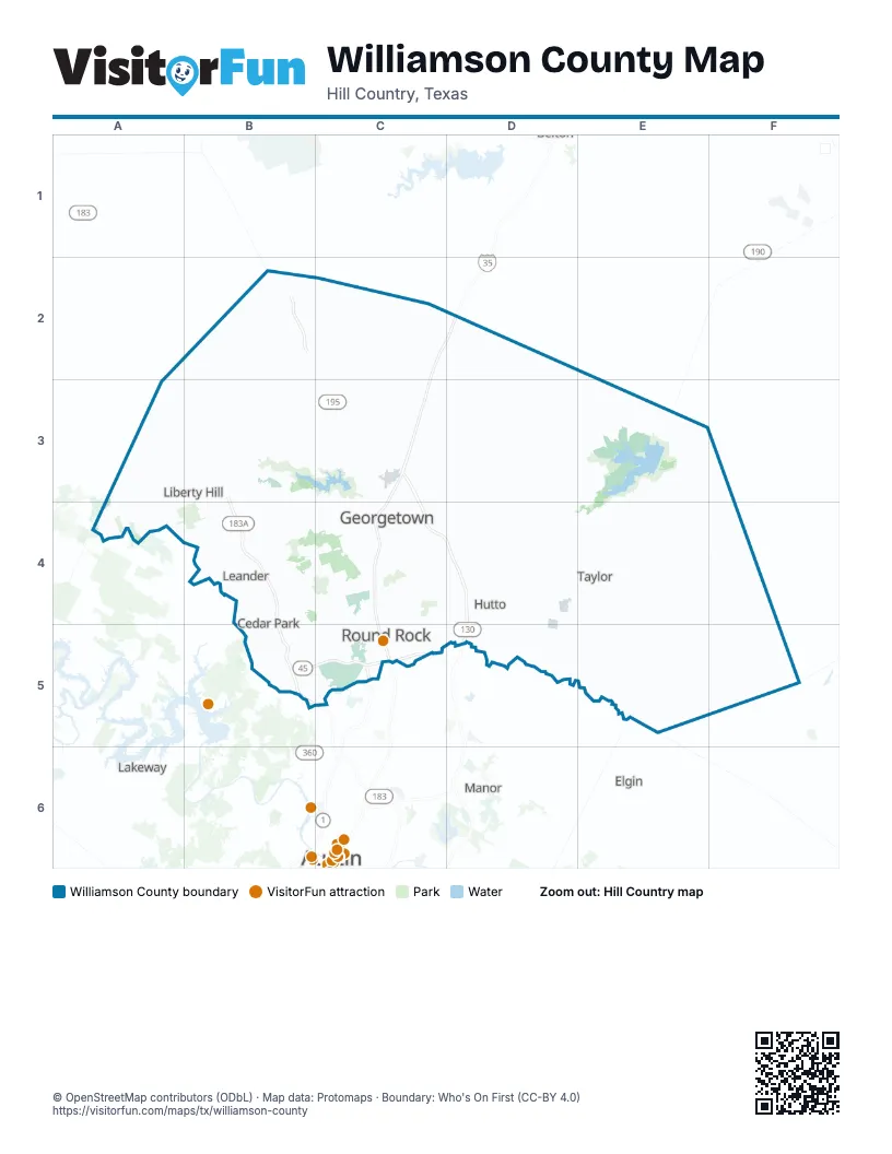
Street index of Williamson County
Each street on the sheet and the grid squares it crosses.
- 183A Toll RoadB3, B4, B5
- Pickle ParkwayC3, C4, D4, D5
- Purple Heart TrailC3, C4, C5
- State Highway 45 NorthB5, C5
- North Mopac ExpresswayC5
Things to do on the Williamson County map
Places on the map
- 1890 Ranch
- Aguado Stone
- Amber Oaks Corporate Park
- Apple
- Austin White Lime
- Avery Ranch Golf Club
- Bailey Park
- Bartlett
- Berry Creek Country Club
- Berry Creek Highlands
- Block House Creek
- Breakaway Park
- Brushy Creek Community Park
- Brushy Creek Greenbelt
- Brushy Creek Lake
- Caballo Ranch
- Carneros Ranch
- Cedar Breaks Park
- Cedar Hollow Crossing
- Cedar Park
- Central Texas Stone
- Champion Stone Company
- Chisholm Valley
- Cimarron Hills
- Cobra Stone
- Cold Springs Subdivision
- Cool Water
- Cooper Stone
- County Glen
- Coupland
- Cowan Creek Golf Club
- Discovery Well Cave Preserve
- Down Home Ranch
- DPS Training Facility
- Eastwood
- Escalera Ranch
- Espinosa Stone Quarry 1
- Espinosa Stone Quarry 2
- Espinosa Stone Quarry 3
- Espinoza Quarry Number 2
Next to Williamson County
- Austin map
- Elgin
- Lakeway
- Manor
© OpenStreetMap contributors (ODbL) · Map data: Protomaps · Boundary: Who's On First (CC-BY 4.0)