

United States map
East North Central States map
The sheet's index lists 21 highways; I-94, I-75 and I-90 cross the most grid squares. Also on it: Akron, Ann Arbor and Appleton.
Open the map (PDF, US Letter)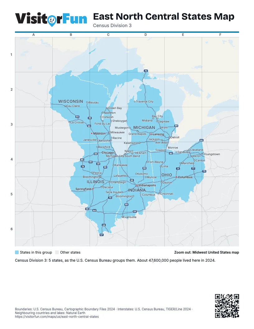
Highway index of East North Central States
Each highway on the sheet and the grid squares it crosses.
- I-24C6
- I-39B2, B3, C3, C4
- I-41C3, C4
- I-43C3, C4
- I-55B5, C4, C5
- I-57C4, C5, C6
- I-64B5, C5, C6, D5, D6
- I-65C4, D4, D5
- I-69C5, C6, D3, D4, D5, E3
- I-70B5, C5, D5, E4, E5, F4
- I-71D5, E4, E5
- I-72B5, C5
- I-74B4, C4, C5, D5
- I-75D1, D2, D3, D4, D5, E3, E4
- I-76E4, F4
- I-77E4, E5
- I-80B4, C4, D4, E4, F4
- I-88B4, C4
- I-90B3, C3, C4, D4, E3, E4, F3
- I-94A2, B2, B3, C3, C4, D3, D4, E3
- I-96D3, E3
Places on the map
- Akron
- Ann Arbor
- Appleton
- Bay City
- Bloomington
- Bloomington
- Canton
- Champaign
- Chicago
- Cincinnati
- Cleveland
- Columbus
- Columbus
- Dayton
- Decatur
- Detroit
- Eau Claire
- Elkhart
- Evansville
- Flint
- Fond du Lac
- Fort Wayne
- Grand Rapids
- Green Bay
- Indianapolis
- Jackson
- Janesville
- Kalamazoo
- Kankakee
- Kenosha
- Kokomo
- La Crosse
- Lafayette
- Lansing
- Lima
- Madison
- Mansfield
- Michigan City
- Midland
- Milwaukee
- Monroe
- Muncie
- Muskegon
- Niles
- Oshkosh
- Peoria
- Racine
- Rockford
- Saginaw
- Sandusky
- Sheboygan
- South Bend
- Springfield
- Terre Haute
- Toledo
- Traverse City
- Wausau
- Youngstown
Boundaries: U.S. Census Bureau, Cartographic Boundary Files 2024 · Interstates: U.S. Census Bureau, TIGER/Line 2024 · Neighbouring countries and lakes: Natural Earth















