

United States map
New England map
The sheet's index lists 6 highways; I-95, I-91 and I-93 cross the most grid squares. Also on it: Augusta, Bangor and Barnstable Town.
Open the map (PDF, US Letter)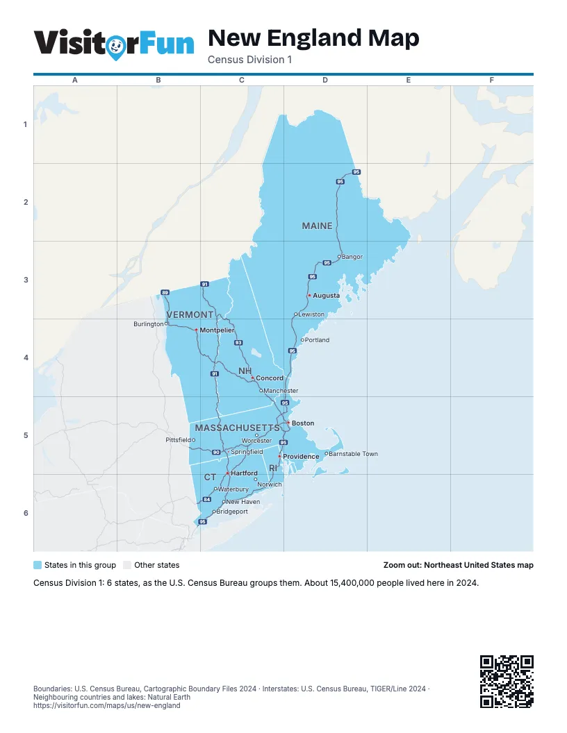
Highway index of New England
Each highway on the sheet and the grid squares it crosses.
- I-84B6, C5, C6
- I-89B3, B4, C4
- I-90B5, C5, D5
- I-91C3, C4, C5, C6
- I-93C3, C4, C5, D5
- I-95B6, C5, C6, D2, D3, D4, D5
Places on the map
- Augusta
- Bangor
- Barnstable Town
- Boston
- Bridgeport
- Burlington
- Concord
- Hartford
- Lewiston
- Manchester
- Montpelier
- New Haven
- Norwich
- Pittsfield
- Portland
- Providence
- Springfield
- Waterbury
- Worcester
Boundaries: U.S. Census Bureau, Cartographic Boundary Files 2024 · Interstates: U.S. Census Bureau, TIGER/Line 2024 · Neighbouring countries and lakes: Natural Earth















