

United States map
Pacific States map
The sheet's index lists 9 highways; I-5, I-15 and I-84 cross the most grid squares. Also on it: Albany, Anchorage and Bakersfield.
Open the map (PDF, US Letter)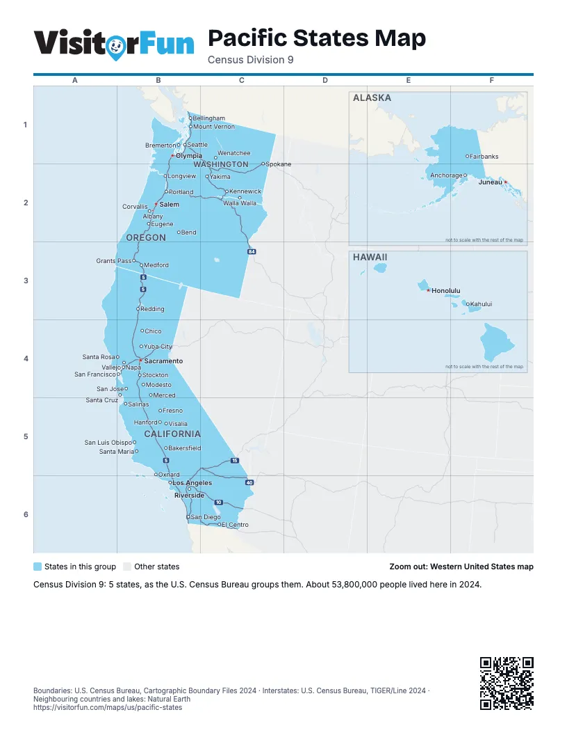
Highway index of Pacific States
Each highway on the sheet and the grid squares it crosses.
- I-5B1, B2, B3, B4, B5, B6
- I-8B6, C6
- I-10B6, C6
- I-15B5, B6, C5
- I-40C5, C6
- I-80B4
- I-82C2
- I-84B2, C2, C3
- I-90B1, C1, C2
Places on the map
- Albany
- Anchorage
- Bakersfield
- Bellingham
- Bend
- Bremerton
- Chico
- Corvallis
- El Centro
- Eugene
- Fairbanks
- Fresno
- Grants Pass
- Hanford
- Honolulu
- Juneau
- Kahului
- Kennewick
- Longview
- Los Angeles
- Medford
- Merced
- Modesto
- Mount Vernon
- Napa
- Olympia
- Oxnard
- Portland
- Redding
- Riverside
- Sacramento
- Salem
- Salinas
- San Diego
- San Francisco
- San Jose
- San Luis Obispo
- Santa Cruz
- Santa Maria
- Santa Rosa
- Seattle
- Spokane
- Stockton
- Vallejo
- Visalia
- Walla Walla
- Wenatchee
- Yakima
- Yuba City
Boundaries: U.S. Census Bureau, Cartographic Boundary Files 2024 · Interstates: U.S. Census Bureau, TIGER/Line 2024 · Neighbouring countries and lakes: Natural Earth















