

Virginia road map
Journey Through Hallowed Ground Byway map
The Journey Through Hallowed Ground Byway has been a National Scenic Byway since 2005, named for its recreational and historic qualities: about 201 miles in Virginia, Maryland and Pennsylvania. It meets 40 highways, among them I-64, I-66 and I-70. Towns along it: Frederick, Leesburg and Charlottesville.
Open the map (PDF, US Letter)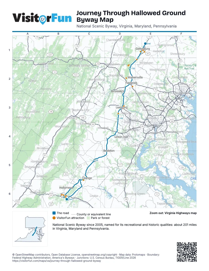
Highways it meets
Each highway it meets and the grid squares where they meet.
- VA 53B6
- I-64B6
- US 250B6
- VA 22B6
- VA 231C6
- US 33C6
- VA 20C6
- US 15C5
- VA 230C5
- VA 299C5
- US 522C5
- VA 3C5
- US 29C5
- VA 28D5
- US 17D4
- VA 215D4
- I-66D4
- VA 55D4
- VA 234D4
- US 50D3
- VA 7D3
- MD 28D3
- MD 464D2
- US 340D2
- I-70D2
- MD 180D2
- MD 351D2
- US 40D2
- MD 26D2
- MD 806D2
- MD 77D2
- MD 550D1
- MD 76D1
- MD 140E1
- MD 873E1
- PA 134E1
- PA 97E1
- US 30E1
- PA 34E1
- PA 116E1
Towns along the Journey Through Hallowed Ground Byway
In mile order, with the grid square of each.
- Rivannamile 2, B6
- Keswickmile 5, B6
- Gordonsvillemile 19, C6
- Orangemile 31, C5
- Culpepermile 48, C5
- Brandy Stationmile 57, C5
- Remingtonmile 63, D5
- Bealetonmile 65, D5
- Opalmile 68, D4
- Warrentonmile 75, D4
- New Baltimoremile 79, D4
- Gainesvillemile 85, D4
- Aldiemile 100, D3
- Leesburgmile 109, D3
- Point of Rocksmile 123, D3
- Ballenger Creekmile 133, D2
- Frederickmile 135, D2
- Walkersvillemile 141, D2
- Lewistownmile 146, D2
- Thurmontmile 152, D2
- Emmitsburgmile 161, E1
- Gettysburgmile 171, E1
- Hunterstownmile 177, C6
- Barboursvillemile 182, C6
- Pantopsmile 196, B6
- Charlottesvillemile 197, B6
Things to do on the Journey Through Hallowed Ground Byway map
© OpenStreetMap contributors, Open Database License, openstreetmap.org/copyright · Map data: Protomaps · Boundary: Federal Highway Administration, America's Byways · Junctions: U.S. Census Bureau, TIGER/Line 2026