

Wisconsin road map
I-39 in Wisconsin map
I-39 is about 179 miles in Wisconsin. It meets 30 highways; US 51, WI 73 and I-90 meet it in the most grid squares. Towns along it: Madison, Janesville and Beloit.
Open the map (PDF, US Letter)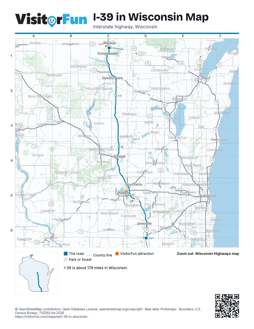
Highways I-39 meets
Each highway it meets and the grid squares where they meet.
- I-90D6
- I-43D6
- WI 81D6
- WI 11D6
- US 14D6
- WI 26D6
- WI 59D5
- US 51C1, C2, C3, C4, D5
- WI 73C2, D5
- WI 106D5
- US 12D5
- US 18D5
- I-94D5
- WI 30D5
- US 151D5
- WI 19C5
- WI 60C4
- WI 78C4
- WI 33C4
- WI 16C4
- WI 23C4
- WI 82C3
- WI 21C3
- WI 54C2
- US 10C2
- WI 66C2
- WI 34C1
- WI 153C1
- WI 51C1
- WI 29C1
Towns along I-39 in Wisconsin
In mile order, with the grid square of each.
- Beloitmile 0, D6
- Janesvillemile 10, D6
- Edgertonmile 24, D5
- Lake Koshkonongmile 25, D5
- McFarlandmile 42, D5
- Madisonmile 43, D5
- DeForestmile 55, C5
- Windsormile 56, C5
- Lake Wisconsinmile 74, C4
- Dekorramile 75, C4
- Portagemile 81, C4
- Endeavormile 94, C3
- Packwaukeemile 97, C3
- Westfieldmile 105, C3
- Colomamile 116, C3
- Hancockmile 123, C3
- Plainfieldmile 129, C2
- Bancroftmile 134, C2
- Plovermile 145, C2
- Whitingmile 148, C2
- Stevens Pointmile 149, C2
- Park Ridgemile 151, C2
- Knowltonmile 166, C1
- Mosineemile 170, C1
- Kronenwettermile 172, C1
- Rib Mountainmile 177, C1
- Rothschildmile 177, C1
Things to do on the I-39 in Wisconsin map
© OpenStreetMap contributors, Open Database License, openstreetmap.org/copyright · Map data: Protomaps · Boundary: U.S. Census Bureau, TIGER/Line 2026















