

Wyoming road map
Wyoming highway map
3 Interstate routes run about 895 miles in Wyoming, each on a sheet of its own. The sheet's index lists 30 highways; US 26, I-80 and US 30 cross the most grid squares. Towns on it: Cheyenne, Casper and Gillette.
Open the map (PDF, US Letter)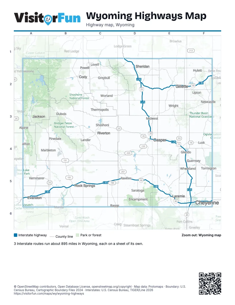
Road maps of Wyoming
3 road maps: each Interstate and byway on a sheet of its own.
Highway index of Wyoming
Each highway on the sheet and the grid squares it crosses.
- I-25D2, D3, D4, E4, F4, F5, F6
- I-80A5, A6, B5, C5, D5, E5, E6, F6
- I-90D1, D2, E2, F2
- I-180F6
- US 14B2, D1, E2, F2
- US 14AB2
- US 16B2, E2, F2
- US 18E4, F3, F4
- US 20B2, C3, D3, D4, E4, F4
- US 26A3, B3, C3, C4, D3, D4, E4, F4, F5
- US 30A4, A5, B5, C5, D5, E5, E6, F6
- US 85F3, F4, F5, F6
- US 87D1, D2, D3, D4, E4, F4, F5, F6
- US 89A3, A4
- US 189A3, A4, A5, A6, B4
- US 191A1, A3, A4, B4, B5
- US 212F1
- US 287A3, B3, C4, D4, D5, E5, E6
- CO 13C6
- SR 16A5
- WY 28B4, B5, C4
- WY 59E2, E3, E4
- WY 89A4, A5, A6
- WY 120B1, B2, C2, C3
- WY 150A6
- WY 220D4
- WY 257D4
- WY 259D3, E3
- WY 387E3
- WY 789C3, C4, C5, C6, D4, D5
Places on the map
- Afton
- Alpine
- Baggs
- Casper
- Cheyenne
- Cody
- Dubois
- Encampment
- Evanston
- Gillette
- Glendo
- Greybull
- Guernsey
- Hulett
- Jackson
- Kemmerer
- Lander
- Laramie
- Lovell
- Lusk
- Marbleton
- Midwest
- Newcastle
- Pinedale
- Powell
- Rawlins
- Riverton
- Rock Springs
- Saratoga
- Sheridan
- Shoshoni
- Thermopolis
- Torrington
- Upton
- Wheatland
- Worland
- Wright
© OpenStreetMap contributors, Open Database License, openstreetmap.org/copyright · Map data: Protomaps · Boundary: U.S. Census Bureau, Cartographic Boundary Files 2024 · Interstates: U.S. Census Bureau, TIGER/Line 2026