

Arkansas road map
Crowley's Ridge Parkway map
Crowley's Ridge Parkway has been a National Scenic Byway since 1998, named for its natural qualities: about 211 miles in Arkansas and Missouri. It meets 37 highways, among them I-40, US 49 and US 62. Towns along it: Jonesboro, Paragould and Forrest City.
Open the map (PDF, US Letter)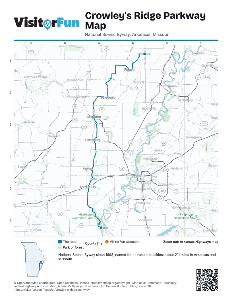
Highways it meets
Each highway it meets and the grid squares where they meet.
- AR 44C6
- AR 185C6
- US 79C6
- AR 1C6
- AR 243C6
- AR 121C5
- AR 131C5
- AR 980C5
- AR 334C5
- US 70C5
- AR 284C5
- I-40C5
- AR 306C5
- US 64C4
- AR 163C4
- AR 364C4
- AR 42C4
- AR 373C4
- AR 14C3
- AR 214C3
- AR 158C3
- AR 69C3
- US 63C3
- US 49C3
- AR 18C3
- AR 351C3
- AR 91C3
- AR 141C3
- AR 168C2
- AR 358C2
- US 412C2
- AR 135C2
- AR 34C2
- AR 90C1
- US 62D1
- AR 139D1
- MO 53D1
Towns along Crowley's Ridge Parkway
In mile order, with the grid square of each.
- Helena-West Helenamile 0, C6
- Mariannamile 24, C6
- Haynesmile 35, C5
- Forrest Citymile 40, C5
- Harrisburgmile 89, C4
- Jonesboromile 105, C3
- Walcottmile 130, C2
- Paragouldmile 136, C2
- Oak Grove Heightsmile 145, C2
- Lafemile 152, C2
- McDougalmile 175, D1
- Pollardmile 182, D1
- Piggottmile 186, D1
- St. Francismile 196, D1
- Campbellmile 200, D1
- Maldenmile 211, D1
Things to do on the Crowley's Ridge Parkway map
© OpenStreetMap contributors, Open Database License, openstreetmap.org/copyright · Map data: Protomaps · Boundary: Federal Highway Administration, America's Byways · Junctions: U.S. Census Bureau, TIGER/Line 2026















