

California map
Bakersfield-Delano Metro Area map
The sheet's index lists 15 highways; I-5, CA 58 and CA 14 cross the most grid squares. Things to do inside the boundary: Buena Vista Museum of Natural History & Science. Also on it: Arvin, Bakersfield and California City.
Open the map (PDF, US Letter)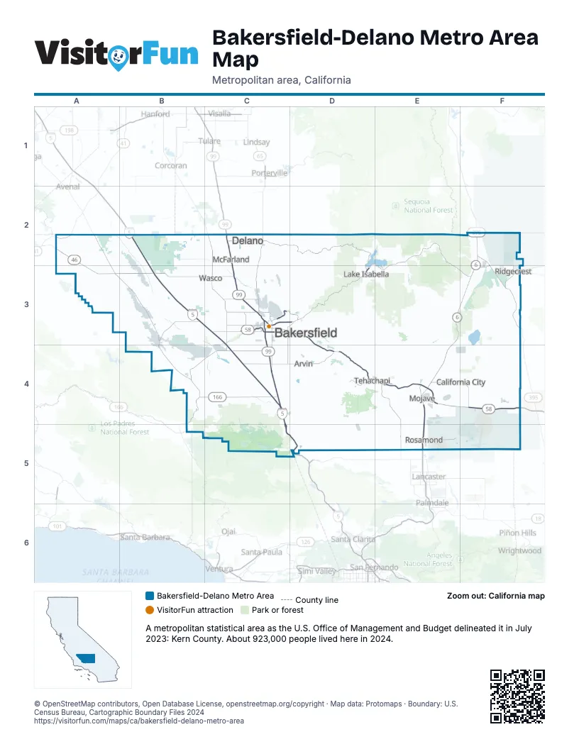
Highway index of Bakersfield-Delano Metro Area
Each highway on the sheet and the grid squares it crosses.
- I-5B2, B3, C3, C4, C5, D5
- US 6E4, F2
- US 99C3, C4, C5, D5
- US 395F2, F3
- CA 14E3, E4, E5, F2, F3
- CA 33B4
- CA 41A2
- CA 43C3
- CA 46A2, A3, B3, C3
- CA 58B3, C3, D3, D4, E4, F4
- CA 65C2, C3
- CA 99C2, C3, C4
- CA 166B4, C4
- CA 178D3
- CA 204C3
Things to do on the Bakersfield-Delano Metro Area map
Places on the map
- Arvin
- Bakersfield
- California City
- Delano
- Lake Isabella
- McFarland
- Mojave
- Ridgecrest
- Rosamond
- Tehachapi
- Wasco
© OpenStreetMap contributors, Open Database License, openstreetmap.org/copyright · Map data: Protomaps · Boundary: U.S. Census Bureau, Cartographic Boundary Files 2024















