

California map
Fresno Metro Area map
The sheet's index lists 9 highways; I-5, CA 99 and CA 41 cross the most grid squares. Things to do inside the boundary: Kings Canyon National Park, Fashion Fair Mall and Mono Wind Casino. Also on it: Chowchilla, Coalinga and Firebaugh.
Open the map (PDF, US Letter)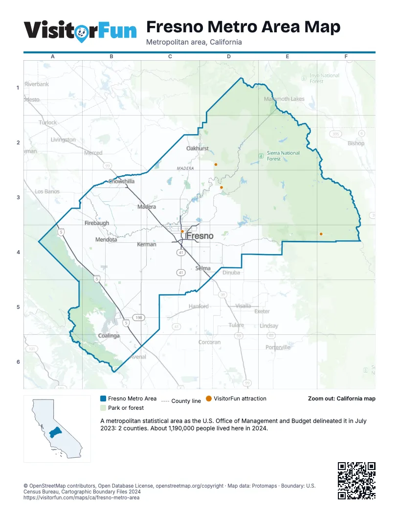
Highway index of Fresno Metro Area
Each highway on the sheet and the grid squares it crosses.
- I-5A4, B4, B5, B6, C6
- CA 33B5
- CA 41C3, C4, C5
- CA 59B3
- CA 99B3, C3, C4, D4
- CA 152B3
- CA 168C3, C4
- CA 180C4
- CA 198B5, C5
Things to do on the Fresno Metro Area map
Places on the map
- Chowchilla
- Coalinga
- Firebaugh
- Fresno
- Kerman
- Madera
- Mendota
- Oakhurst
- Selma
© OpenStreetMap contributors, Open Database License, openstreetmap.org/copyright · Map data: Protomaps · Boundary: U.S. Census Bureau, Cartographic Boundary Files 2024















