

California map
Sacramento-Roseville-Folsom Metro Area map
The sheet's index lists 13 highways; I-80, US 50 and I-5 cross the most grid squares. Things to do inside the boundary: Emerald Bay State Park, Godfather Crime Tour and Palisades Tahoe. Also on it: Auburn, Elk Grove and Folsom.
Open the map (PDF, US Letter)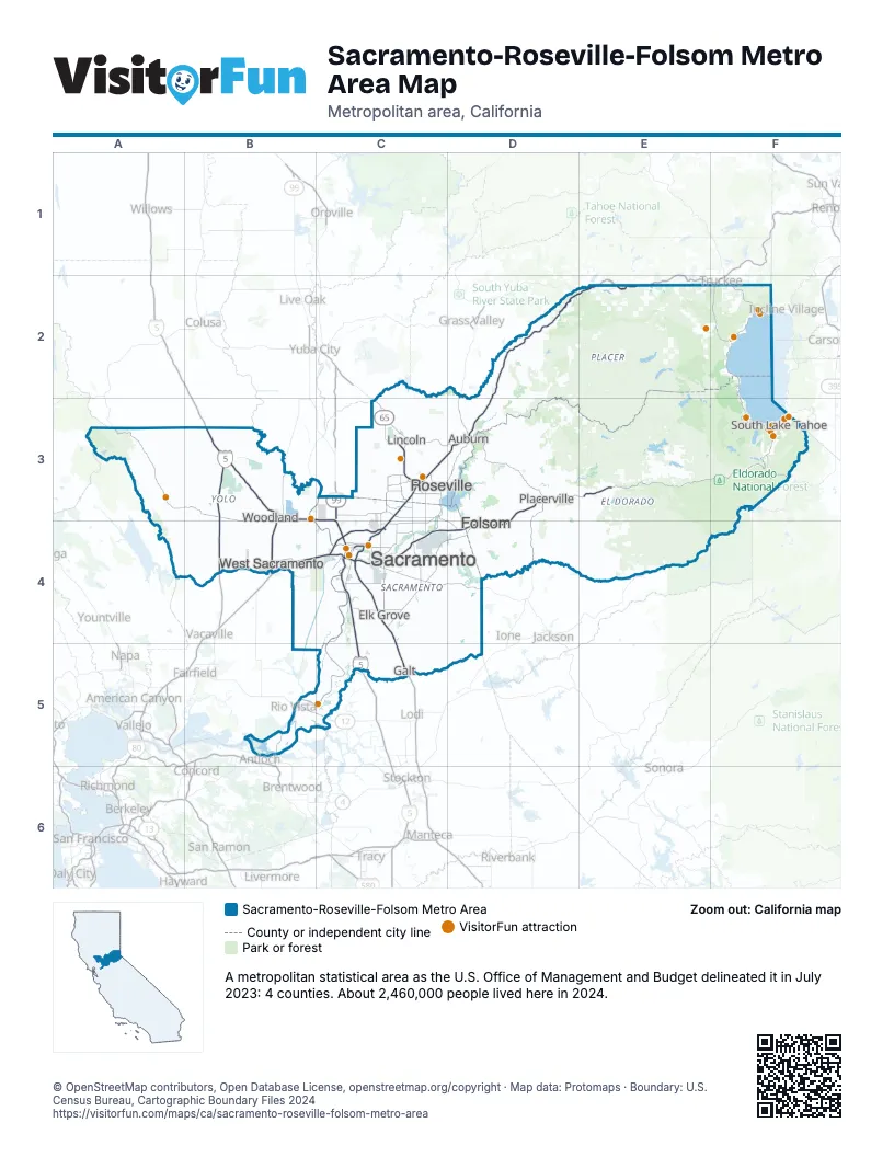
Highway index of Sacramento-Roseville-Folsom Metro Area
Each highway on the sheet and the grid squares it crosses.
- I-5B3, C3, C4, C5
- I-80B4, C3, C4, D2, D3, E2
- I-505B3, B4
- US 50C4, D3, D4, E3, F3
- CA 12B5, C5
- CA 20E2
- CA 49D3
- CA 65C3
- CA 89F3
- CA 99C3, C4, C5
- CA 113B3, B4
- CA 160B5, C4
- CA 244C4
Things to do on the Sacramento-Roseville-Folsom Metro Area map
- Emerald Bay State Park
- Godfather Crime Tour
- Palisades Tahoe
- Tahoe Bleu Wave
- Tahoe Gal
- Tahoe Party Boat
- Tahoe Tastings
- Anderson's Bicycle Rental
- Arden Fair Mall
- Boat Tahoe
- Cache Creek Casino Resort
- Camp Richardson Corral
- Cruise Tahoe
- Efoil Tahoe
- Explore Tahoe Visitor Center
- Isleton Asian American Heritage Park
- MOSAC (SMUD Museum of Science and Curiosity)
- North Lake Tahoe Boat Rental
- North Tahoe Regional Park
- Pine Nut E-Bike Rentals
- Placer Valley
- Powder House Ski & Snowboard
- River Fox Train
- SUP Tahoe
- Tahoe Adventure Company
- Tahoe Club Crawl
- Tahoe Dave's Skis & Boards
- Tahoe Helicopters
- Tahoe Snowmobiles & Tubing
- Tahoe Sport Fishing
- Tahoe Sports
- Tahoe Trout Farm
- Tahoe WakeBusters
- The California Museum
- The Shops at Heavenly Village
- Thunder Valley Casino Resort
- Trapped in Tahoe
Places on the map
- Auburn
- Elk Grove
- Folsom
- Galt
- Lincoln
- Placerville
- Roseville
- Sacramento
- South Lake Tahoe
- West Sacramento
- Woodland
© OpenStreetMap contributors, Open Database License, openstreetmap.org/copyright · Map data: Protomaps · Boundary: U.S. Census Bureau, Cartographic Boundary Files 2024















