

California road map
Volcanic Legacy Scenic Byway map
The Volcanic Legacy Scenic Byway has been an All-American Road since 2002, named for its natural and recreational qualities: about 496 miles in California and Oregon. It meets 17 highways, among them I-5, US 97 and CA 32. Towns along it: Klamath Falls, Mount Shasta and Weed.
Open the map (PDF, US Letter)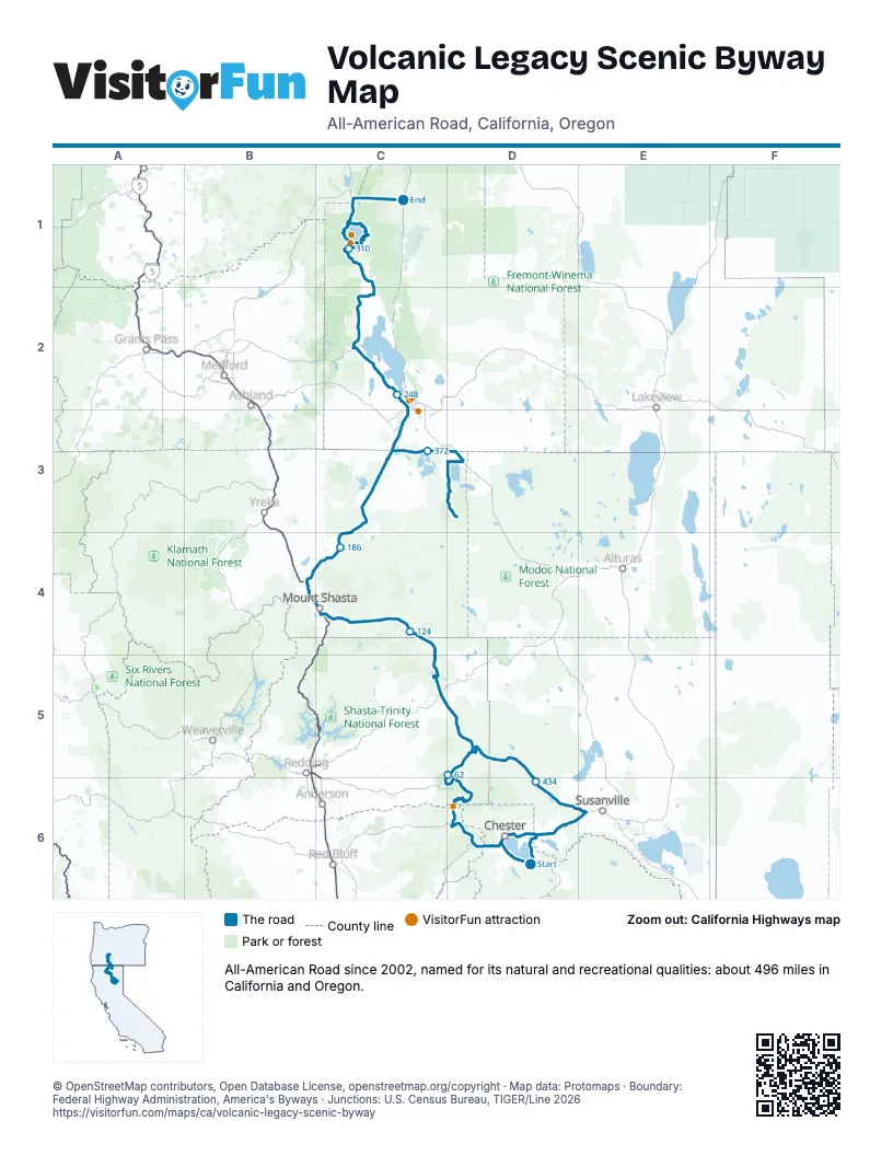
Highways it meets
Each highway it meets and the grid squares where they meet.
- CA 147D6
- CA 89D6
- CA 36D6
- CA 32D6
- CA 172D6
- CA 44C6
- CA 299C5
- I-5C4
- US 97B4
- CA 265B4
- CA 161C3
- OR 66C2
- OR 140C2
- OR 62C1
- OR 138C1
- OR 161C3
- CA 139D3
Towns along the Volcanic Legacy Scenic Byway
In mile order, with the grid square of each.
- Canyondammile 1, D6
- Prattvillemile 5, D6
- Almanormile 7, D6
- Lake Almanor Westmile 9, D6
- Chestermile 13, D6
- Mineralmile 33, D6
- Old Stationmile 73, D5
- Hat Creekmile 80, D5
- Johnson Parkmile 97, C5
- McCloudmile 146, C4
- Dunsmuirmile 154, C4
- Mount Shastamile 157, C4
- Weedmile 167, B4
- Mount Hebronmile 209, C3
- Macdoelmile 212, C3
- Dorrismile 223, C3
- Klamath Fallsmile 242, C2
- Running Y Ranchmile 249, C2
- Rocky Pointmile 268, C2
- Fort Klamathmile 293, C2
- Tulelakemile 384, D3
- Westwoodmile 468, D6
- Clear Creekmile 473, D6
- Lake Almanor Peninsulamile 479, D6
- East Shoremile 489, D6
- Hamilton Branchmile 489, D6
Things to do on the Volcanic Legacy Scenic Byway map
© OpenStreetMap contributors, Open Database License, openstreetmap.org/copyright · Map data: Protomaps · Boundary: Federal Highway Administration, America's Byways · Junctions: U.S. Census Bureau, TIGER/Line 2026















