

Colorado road map
Colorado highway map
5 Interstate routes run about 928 miles in Colorado, each on a sheet of its own. The sheet's index lists 48 highways; US 50, US 287 and US 40 cross the most grid squares. Towns on it: Denver, Colorado Springs and Fort Collins.
Open the map (PDF, US Letter)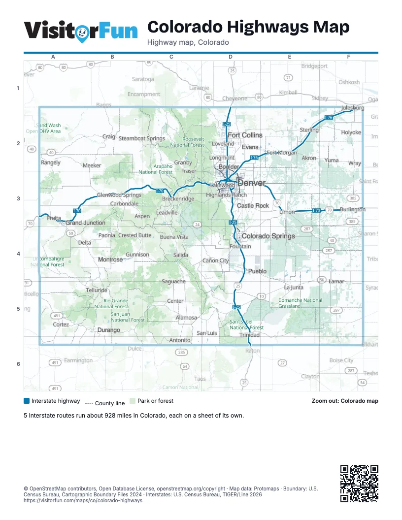
Road maps of Colorado
14 road maps: each Interstate and byway on a sheet of its own.
- I-25 in Colorado
- I-70 in Colorado
- I-76 in Colorado
- I-225 in Colorado
- I-270 in Colorado
- Colorado River Headwaters Byway
- Frontier Pathways Scenic and Historic Byway
- Gold Belt Tour Scenic and Historic Byway
- Lariat Loop Scenic and Historic Byway
- San Juan Skyway
- Scenic Highway of Legends
- Silver Thread Colorado Scenic and Historic Byway
- Top of the Rockies
- Trail Ridge Road/Beaver Meadow Road
Highway index of Colorado
Each highway on the sheet and the grid squares it crosses.
- I-25D1, D2, D3, D4, D5, D6
- I-70A3, B3, C3, D3, E3, F3
- I-76D2, D3, E2, F1, F2
- I-225D3
- I-270D3
- US 6A3, B3, C3, D3
- US 24C3, C4, D3, D4, E3, F3
- US 34D2, E2
- US 36D2, D3, F3
- US 40A2, B2, C2, D3, E3, E4, F4
- US 50A3, A4, B4, C4, D4, E4, E5, F4, F5
- US 85D1, D2, D3
- US 87D1, D3
- US 160A5, A6, B5, C5, D5
- US 285C3, C4, C5, C6, D3
- US 287D1, D2, D3, E3, E4, F4, F5, F6
- US 385F1, F2, F3, F4, F5, F6
- US 400F5
- US 491A5, A6
- US 550B4, B5, B6
- CO 2D3
- CO 7D2
- CO 9C2, C3, C4
- CO 10D5, E5
- CO 13B1, B2, B3
- CO 14D2
- CO 16D4
- CO 17C4, C5, C6
- CO 21D4
- CO 47D4
- CO 58D3
- CO 66D2
- CO 67D4
- CO 71E5
- CO 82B3
- CO 83D3, D4
- CO 86D3, E3
- CO 88D3
- CO 93D2, D3
- CO 96D4, F4
- CO 115D4
- CO 119D2
- CO 121D3
- CO 141A4
- CO 157D2
- CO 257D2
- CO 392D2
- CO 470D3
Places on the map
- Akron
- Alamosa
- Antonito
- Aspen
- Boulder
- Breckenridge
- Buena Vista
- Burlington
- Cañon City
- Carbondale
- Castle Rock
- Center
- Colorado Springs
- Cortez
- Craig
- Crested Butte
- Delta
- Denver
- Durango
- Evans
- Fort Collins
- Fort Morgan
- Fountain
- Fraser
- Fruita
- Glenwood Springs
- Granby
- Grand Junction
- Gunnison
- Highlands Ranch
- Holyoke
- Julesburg
- La Junta
- Lakewood
- Lamar
- Leadville
- Limon
- Longmont
- Loveland
- Meeker
- Montrose
- Paonia
- Pueblo
- Rangely
- Saguache
- Salida
- San Luis
- Steamboat Springs
- Sterling
- Telluride
- Trinidad
- Wray
- Yuma
© OpenStreetMap contributors, Open Database License, openstreetmap.org/copyright · Map data: Protomaps · Boundary: U.S. Census Bureau, Cartographic Boundary Files 2024 · Interstates: U.S. Census Bureau, TIGER/Line 2026















