

Colorado road map
San Juan Skyway map
The San Juan Skyway has been an All-American Road since 1996, named for its historic and scenic qualities: a loop of about 231 miles in Colorado. It meets 6 highways, among them US 160, US 550 and CO 62. Towns along it: Durango, Cortez and Telluride.
Open the map (PDF, US Letter)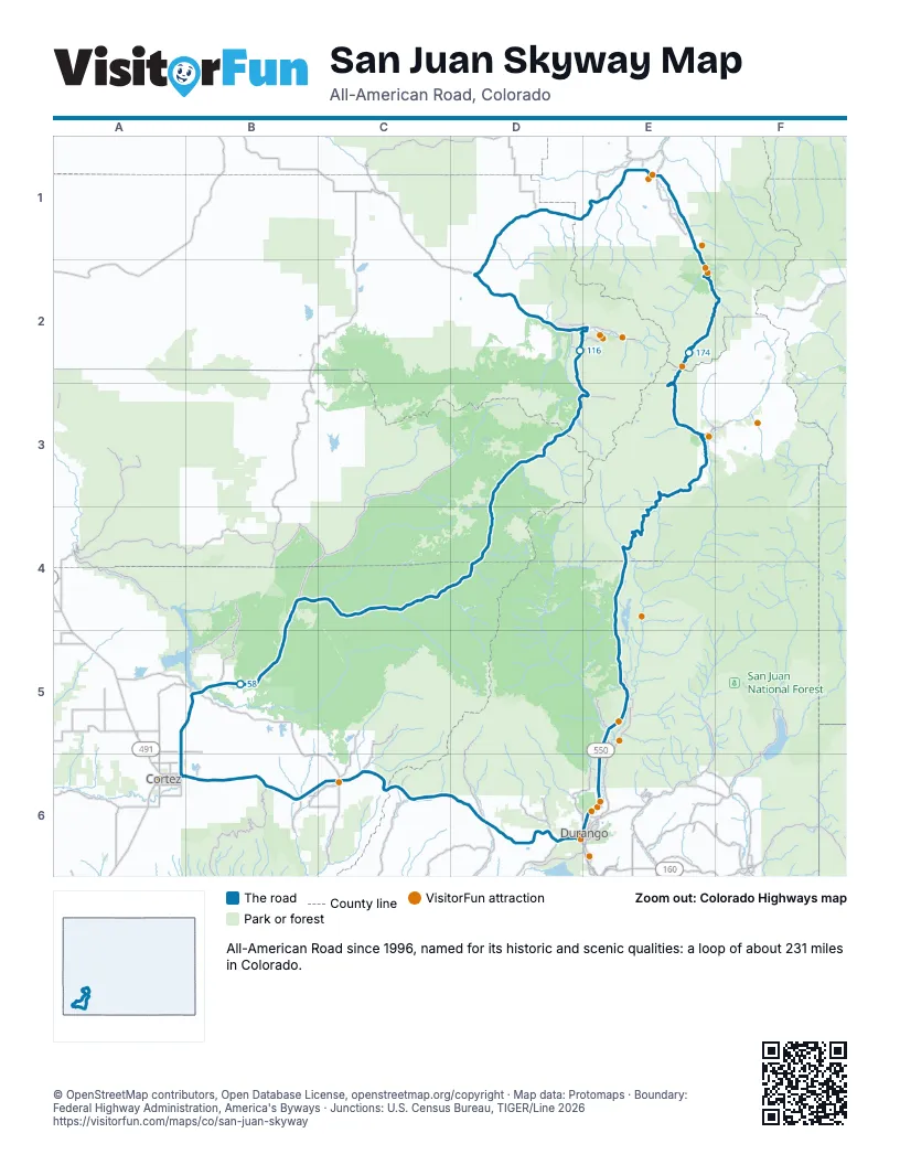
Highways it meets
Each highway it meets and the grid squares where they meet.
- US 160D6
- CO 140D6
- CO 184C6
- CO 145A6
- CO 62D2
- US 550E1
Towns along the San Juan Skyway
In mile order, with the grid square of each.
- Durangomile 0, D6
- Mancosmile 27, C6
- Cortezmile 45, A6
- Doloresmile 55, B5
- Ricomile 93, D4
- Mountain Villagemile 116, D2
- Telluridemile 117, D2
- Placervillemile 127, D2
- Ridgwaymile 152, E1
- Portlandmile 158, E1
- Ouraymile 163, E1
- Silvertonmile 184, E3
Things to do on the San Juan Skyway map
- Mesa Verde Stables
- Action Adventures Trail Rides
- RIGS Fly Shop & Guide Service
- Bachelor Syracuse Mine Tour
- Ouray Visitor Center
- Ouray County Museum
- Million Dollar Highway
- Honeyville
- Durango Hot Springs Resort and Spa
- Mild to Wild Rafting & Jeep Tours
- Durango Flight Tours
- Durango Rivertrippers & Adventure Tours
- The Powerhouse
- Barons Creek Vineyards
- Durango & Silverton Narrow Gauge Railroad
© OpenStreetMap contributors, Open Database License, openstreetmap.org/copyright · Map data: Protomaps · Boundary: Federal Highway Administration, America's Byways · Junctions: U.S. Census Bureau, TIGER/Line 2026















