

Colorado map
Colorado Springs Metro Area map
The sheet's index lists 7 highways; US 24, I-25 and CO 21 cross the most grid squares. Things to do inside the boundary: Cave of the Winds Mountain Park, Chapel Hills Mall and Cheyenne Mountain Zoo. Also on it: Black Forest, Colorado Springs and Cripple Creek.
Open the map (PDF, US Letter)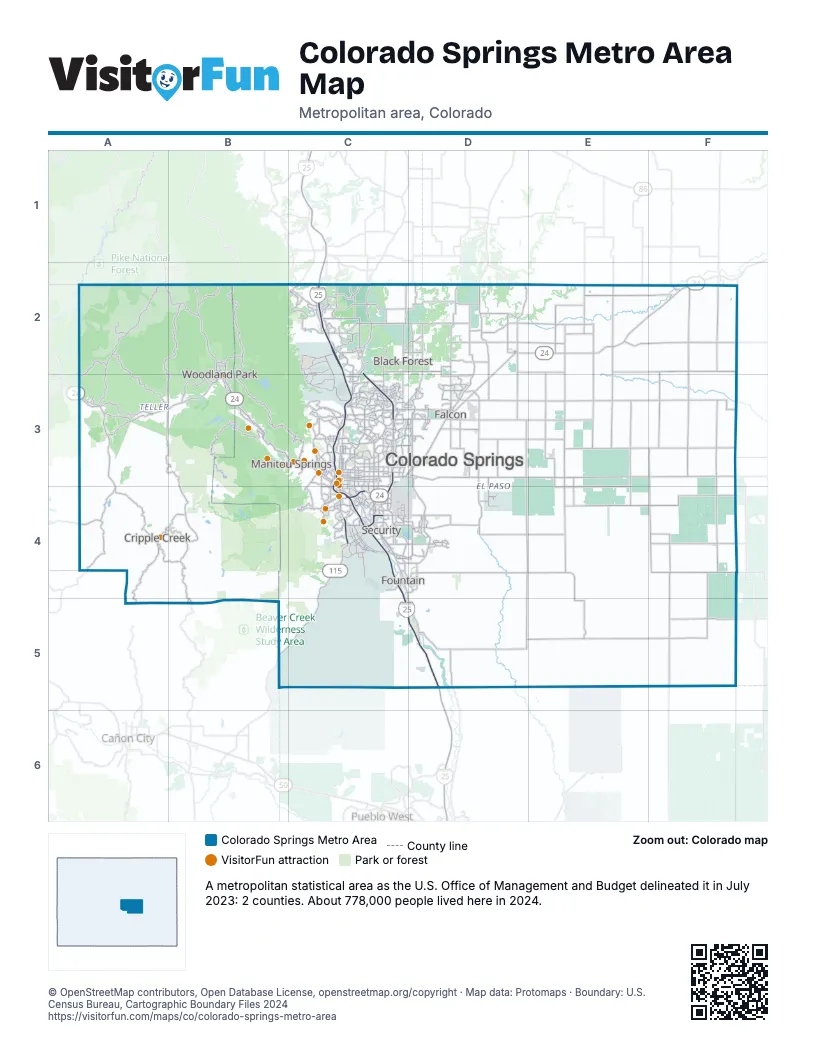
Highway index of Colorado Springs Metro Area
Each highway on the sheet and the grid squares it crosses.
- I-25C2, C3, C4, C5, D5
- US 24A3, B2, B3, C3, C4, D2, D3, E2, F2
- CO 16C4, D4
- CO 21C2, C3, C4, D4
- CO 67A3, B3
- CO 83C2
- CO 115B5, C4, C5
Things to do on the Colorado Springs Metro Area map
- Cave of the Winds Mountain Park
- Chapel Hills Mall
- Cheyenne Mountain Zoo
- Colorado Springs Visitor Information Center
- Cripple Creek & Victor Narrow Gauge Railroad
- Dinosaur Resource Center
- Downtown Colorado Springs
- Edelweiss Restaurant
- Edward C. Rochette Money Museum
- Flying W Ranch
- Garden of the Gods
- Garden of the Gods Trading Post
- Manitou Cliff Dwellings Museum
- Manitou Incline
- Open Road Rentals
- Pikes Peak - America's Mountain
- Rocky Mountain Food Tours
- The Broadmoor
- United States Air Force Academy
- US Olympic & Paralympic Museum
Places on the map
- Black Forest
- Colorado Springs
- Cripple Creek
- Falcon
- Fountain
- Manitou Springs
- Security
- Woodland Park
© OpenStreetMap contributors, Open Database License, openstreetmap.org/copyright · Map data: Protomaps · Boundary: U.S. Census Bureau, Cartographic Boundary Files 2024