

Florida map
Collier County map
About 416,233 people live here (Census Bureau, 2024 estimate). The sheet's index lists Alligator Alley. Things to do inside the boundary: Big Cypress National Preserve.
Open the map (PDF, US Letter)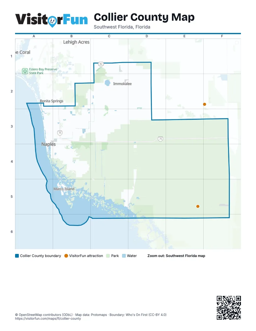
Street index of Collier County
Each street on the sheet and the grid squares it crosses.
- Alligator AlleyB3, C3, D3, E3
Things to do on the Collier County map
Places on the map
- Arrowhead Reserve
- Artesia
- Audubon Country Club
- Autumn Woods
- Avalon Estates
- Ave Maria
- Aviamar
- Barefoot Beach State Preserve
- Bay Colony Golf Club
- Bear's Paw
- Big Cypress Bend Boardwalk
- Big Cypress National Preserve
- Bird Rookery Swamp
- Bonita Bay East
- Briarwood
- Calusa Pines Golf Club
- Caracara Prairie Preserve
- Carlton Lakes
- CAYMAS
- Charity Island
- Chokoloskee
- Clam Pass Park
- Classics Plantation Estates
- Club Pelican Bay
- Collier County
- Collier Family Farms
- Collier-Seminole State Park
- Collier’s Reserve Country Club
- Corkscrew Marsh
- Corkscrew Swamp Sanctuary
- Emerald Lakes
- Esplanade by the Islands
- Esplanade Golf
- Estuary at Grey Oaks
- Everglades City
- Fakahatchee Strand Preserve State Park
- Falling Waters
- Fiddler's Creek
- Florida Panther National Wildlife Refuge
- Forest Lake Homes
Next to Collier County
- Bonita Springs
- Cape Coral map
- Lehigh Acres
© OpenStreetMap contributors (ODbL) · Map data: Protomaps · Boundary: Who's On First (CC-BY 4.0)