

Florida map
Southwest Florida map
The sheet's index lists 15 highways; I-75, SR 70 and SR 29 cross the most grid squares. Things to do inside the boundary: Ah-Tah-Thi-Ki Museum, Anna Maria Island Historical Society Museum and Big Cypress National Preserve. Also on it: Arcadia, Bonita Springs and Bradenton.
Open the map (PDF, US Letter)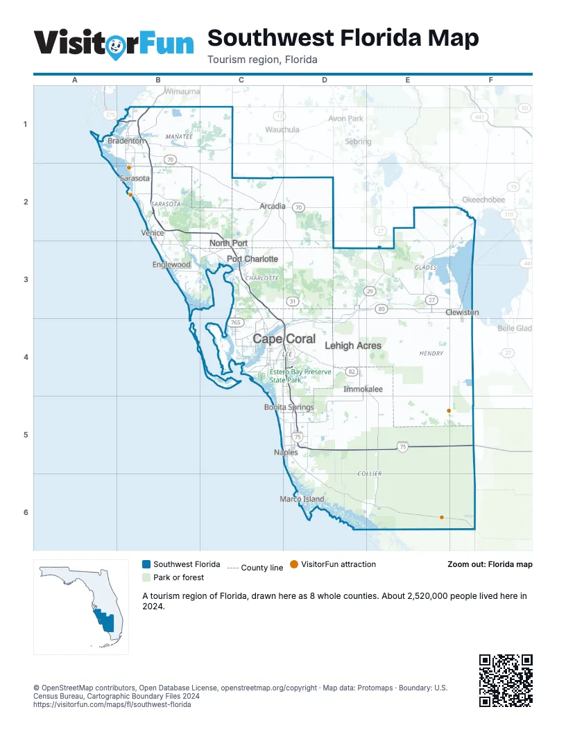
Highway index of Southwest Florida
Each highway on the sheet and the grid squares it crosses.
- I-75B1, B2, C2, C3, C4, D4, D5, E5, F5
- I-275B1
- US 17C2, C3, D2
- US 19B1
- US 27E3, F3
- US 41B1
- US 301B1
- SR 29D3, D4, E3, E5
- SR 31C2, D2, D3, D4
- SR 70B1, B2, C2, D2, E2
- SR 78E3
- SR 80D3, D4, E3, F3
- SR 82D4
- SR 681B2
- SR 884C4, D4
Things to do on the Southwest Florida map
- Ah-Tah-Thi-Ki Museum
- Anna Maria Island Historical Society Museum
- Big Cypress National Preserve
- Bradenton Riverwalk
- De Soto National Memorial
- Edison and Ford Winter Estates
- Edison Mall
- Koreshan State Historic Site
- Manatee County Agricultural Museum
- Manatee Village Historical Park
- Mote Science Education Aquarium (Mote SEA)
- Myakka River State Park
- Naples Botanical Garden
- Port Charlotte Town Center
- Sarasota Jungle Gardens
- Seminole Casino Hotel Immokalee
- Siesta Beach
- The Ringling
- Waterside Shops
Places on the map
- Arcadia
- Bonita Springs
- Bradenton
- Cape Coral
- Clewiston
- Englewood
- Immokalee
- Lehigh Acres
- Marco Island
- Naples
- North Port
- Port Charlotte
- Sarasota
- Venice
Next to Southwest Florida
- Central East Florida map
- Central Florida map
- Central West Florida map
- Southeast Florida
© OpenStreetMap contributors, Open Database License, openstreetmap.org/copyright · Map data: Protomaps · Boundary: U.S. Census Bureau, Cartographic Boundary Files 2024