

Georgia map
Forsyth County map
About 280,096 people live here (Census Bureau, 2024 estimate). The sheet's index lists 48 streets; Turner McDonald Parkway, Browns Bridge Road and Matt Highway cross the most grid squares. Also on it: 400 Overlook Business Park, Aberdeen and Antioch Water Treatment Plant.
Open the map (PDF, US Letter)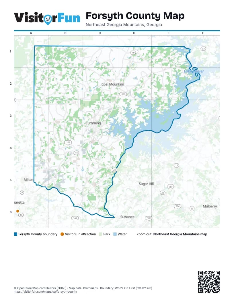
Street index of Forsyth County
Each street on the sheet and the grid squares it crosses.
- Matt HighwayB1, A2, B2, C2
- Dahlonega HighwayC1, C2, C3
- Jot Em Down RoadD1, E1, E2
- Dawsonville HighwayE1, F1
- Keith Bridge RoadE1, C2, D2, E2
- State Route 53E1
- Westbrook RoadE1
- Browns Bridge RoadC2, D2, E2, F2, D3, E3
- Georgia 400C2
- Turner McDonald ParkwayC2, D2, C3, B4, C4, A5, B5
- Freedom ParkwayD2, C3
- Canton HighwayA3, B3, C3
- Bethelview RoadB3, B4
- Kelly Mill RoadB3
- Post RoadB3, A4, B4
- Atlanta RoadC3, C4
- Bald Ridge Marina RoadC3
- Canton RoadC3
- Castleberry RoadC3, B4, C4
- Dahlonega RoadC3
- Dahlonega StreetC3
- East Main StreetC3
- East Maple StreetC3
- Market Place BoulevardC3, C4
- North Main StreetC3
- Pirkle Ferry RoadC3
- Veterans Memorial BoulevardC3, C4
- West Courthouse SquareC3
- West Maple StreetC3
- Atlanta HighwayA4, B4, C4, A5
- Mullinax RoadA4, A5, B5
- Peachtree ParkwayB4, B5, B6
- Ronald Reagan BoulevardB4, C4, A5, B5
- Shiloh RoadB4
- Buford HighwayC4, C5
- McFarland ParkwayA5, B5
- McGinnis Ferry RoadA5, B5, B6, C6
- Union Hill RoadA5, B5
- Bluegrass Valley ParkwayB5
- Brookwood RoadB5, B6
- Commonwealth TrailB5
- Mathis Airport ParkwayB5, C5
- Sharon RoadB5, C5
- Windward ParkwayB5
- Cumming HighwayC5
- Old Atlanta RoadC5, C6
- Windermere ParkwayC5
- Medlock Bridge RoadB6
Places on the map
- 400 Overlook Business Park
- Aberdeen
- Antioch Water Treatment Plant
- Arbor Meadows
- Arbors at Lake View
- Arden Greens at Windermere
- Atlanta Cricket Fields
- AutomationDirect
- Autumn Ridge
- Avignon
- Avonleigh
- Bagley Farm
- Bald Ridge Creek Campground
- Bald Ridge Marina
- Bennett Park
- Bennington at Windemere
- Bethany Springs
- Bethelwood Lakes
- Big Creek Township
- Blackburn Ridge
- Blackstone
- Blackwell Manor
- Blount Construction Company
- Brackley
- Bradley Park Apartment Homes
- Brandon Hall
- Brannon Oaks
- Bridgehampton
- Bridleton
- Brookemeade Trail
- Brookside Heights
- Buford Trout Hatchery
- Burgess Hill
- Caney Creek Preserve
- Central Park
- Chamblee Estates
- Champions Run
- Charleston Park
- Chartwell
- Chattahoochee Pointe Park
Next to Forsyth County
- Alpharetta
- Buford
- Milton
- Mulberry
- Sugar Hill
- Suwanee
© OpenStreetMap contributors (ODbL) · Map data: Protomaps · Boundary: Who's On First (CC-BY 4.0)