

Iowa road map
I-29 in Iowa map
I-29 is about 150 miles in Iowa. It has 49 exits, from Exit 1 at mile 2 to Exit 151 at mile 149. It meets 17 highways, among them I-80, I-129 and I-680.
Open the map (PDF, US Letter)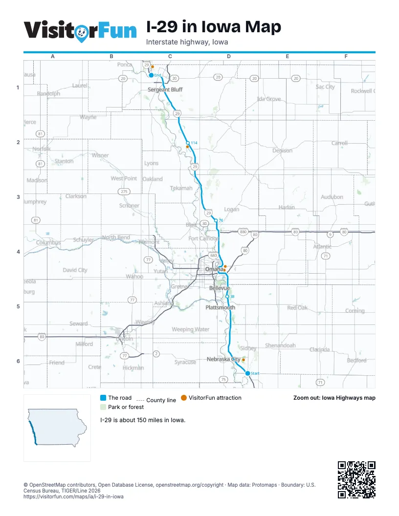
Exits on I-29 in Iowa
Each exit in mile order, with its grid square.
- Exit 1mile 2, D6
- Exit 10mile 10, D6
- Exit 15mile 15, D6
- Exit 20mile 19, D6
- Exit 24mile 24, D5
- Exit 32mile 33, D5
- Exit 35 A-Bmile 35, D5
- Exit 35 B-Amile 36, D5
- Exit 42mile 42, D5
- Exit 47mile 47, D4
- Exit 48Amile 48, D4
- Exit 4mile 49, D4
- Exit 48mile 49, D4
- Exit 49mile 49, D4
- Exit 50mile 50, D4
- Exit 51mile 51, D4
- Exit 52mile 52, D4
- Exit 53Amile 52, D4
- Exit 53Bmile 53, D4
- Exit 55mile 54, D4
- Exit 56mile 56, D4
- Exit 61Amile 60, D4
- Exit 3Bmile 61, D4
- Exit 61Bmile 61, D4
- Exit 66mile 65, D4
- Exit 71mile 70, D4
- Exit 72mile 71, D4
- Exit 75mile 75, D3
- Exit 82mile 81, D3
- Exit 89mile 88, D3
- Exit 95mile 94, D3
- Exit 105mile 103, C2
- Exit 112mile 110, C2
- Exit 120mile 118, C2
- Exit 127mile 126, C2
- Exit 134mile 133, C1
- Exit 135mile 134, C1
- Exit 141mile 139, C1
- Exit 143mile 141, C1
- Exit 144Amile 142, C1
- Exit 144Bmile 143, C1
- Exit 1Bmile 143, C1
- Exit 144mile 143, C1
- Exit 147Amile 145, C1
- Exit 147Bmile 146, C1
- Exit 148mile 146, C1
- Exit 147mile 146, C1
- Exit 149mile 147, C1
- Exit 151mile 149, C1
Highways I-29 meets
Each highway it meets and the grid squares where they meet.
- IA 333D6
- IA 2D6
- US 34D5
- US 275D5
- IA 92D4
- I-80D4
- US 6D4
- I-680D4
- US 30D4
- IA 127D3
- IA 175C2
- IA 141C2
- I-129C1
- US 75C1
- US 20C1
- US 77C1
- IA 12C1
Towns along I-29 in Iowa
In mile order, with the grid square of each.
- Hamburgmile 1, D6
- Percivalmile 15, D6
- Pacific Junctionmile 33, D5
- Council Bluffsmile 44, D5
- Carter Lakemile 53, D4
- Missouri Valleymile 74, D4
- Modalemile 81, D3
- Mondaminmile 87, D3
- Little Siouxmile 94, D3
- Blencoemile 103, C2
- Onawamile 109, C2
- Sloanmile 126, C2
- Salixmile 132, C1
- Sioux Citymile 137, C1
- Sergeant Bluffmile 138, C1
© OpenStreetMap contributors, Open Database License, openstreetmap.org/copyright · Map data: Protomaps · Boundary: U.S. Census Bureau, TIGER/Line 2026















