

Iowa map
Iowa Township map
About 76,710 people live here (Census Bureau, 2024 estimate). The sheet's index lists 51 streets; Great River Road, Iowa River Drive and Pine Tree Drive cross the most grid squares. Also on it: Blackhawk Point Wildlife Management Area, Duck Lake and Fish Farms Mounds Wildlife Area.
Open the map (PDF, US Letter)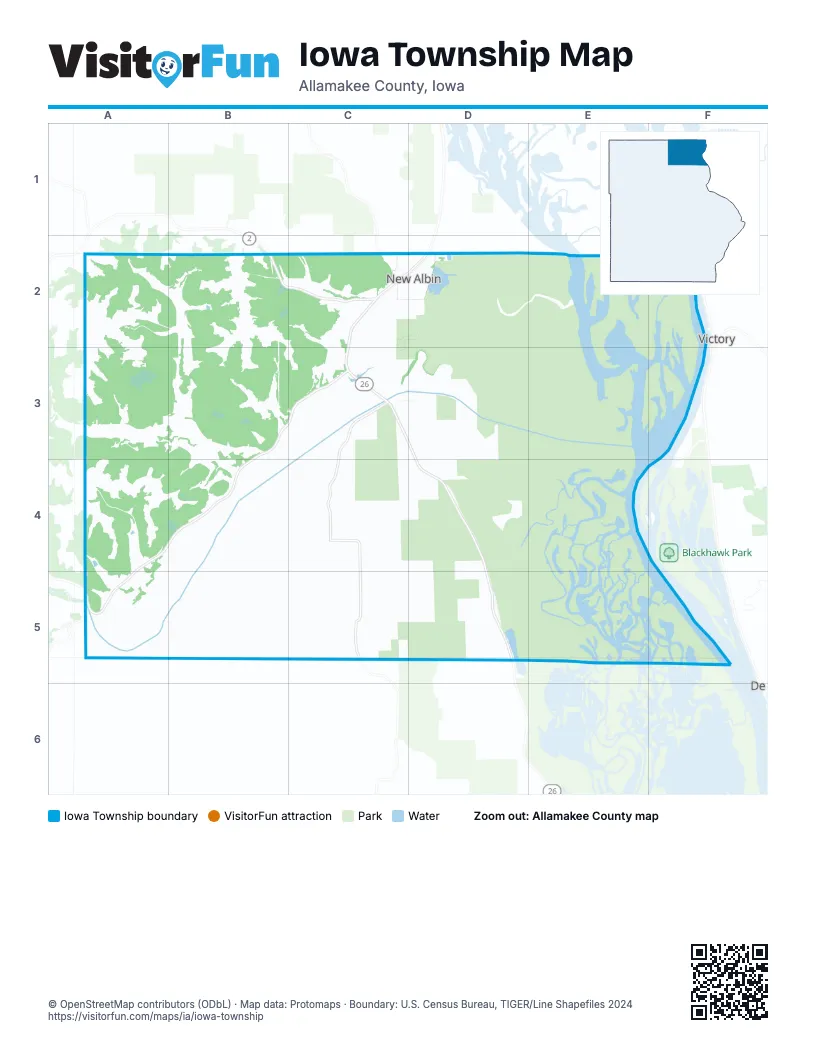
Street index of Iowa Township
Each street on the sheet and the grid squares it crosses.
- Burmester RoadA2, A3
- Irish Hollow RoadA2, B2, B3
- Oriole DriveA2, B2
- Pool Hill DriveB2, C2
- 1st Street SoutheastC2, D2
- 2nd Street SoutheastC2, D2
- Aspen StreetC2
- Balsam StreetC2
- Cemetery RoadC2, C3
- Great River RoadC2, C3, D3, D4, D5
- Locust StreetC2, D2
- Main StreetC2, D2
- Pleasant AvenueC2
- Pleasant CourtC2
- Railroad AvenueC2
- Railroad StreetC2, D2
- Rogers RoadC2
- Rogers StreetC2
- Ross AvenueC2, D2
- Sunrise CourtC2
- Terrace DriveC2
- Walnut StreetC2
- Winnebago RoadC2
- 1st Street NortheastD2
- 2nd Street NortheastD2
- 3rd Street NortheastD2
- 4th StreetD2
- 4th Street NortheastD2
- 4th Street SoutheastD2
- 5th Street SoutheastD2
- Army RoadD2, E2
- Ash StreetD2
- CherryD2
- Cherry StreetD2
- Elm StreetD2
- Hickory StreetD2
- MapleD2
- OakD2
- Oak StreetD2
- PlumD2
- Hemlock DriveA3, B3
- Iowa River DriveB3, C3, A4, B4, A5
- Black Hawk RoadC3, C4
- Wabasha DriveC3
- Waters RoadA4
- Morgan Bridge RoadB4
- Pine Tree DriveB4, C4, A5, B5
- Sand Cove RoadC4, C5
- Cedar Hill RoadC5
- Desert DriveC5
- Moore Hill RoadC5
Places on the map
- Blackhawk Point Wildlife Management Area
- Duck Lake
- Fish Farms Mounds Wildlife Area
- Grace United Methodist Church
- Hayes Lake Roadside Park
- Holy Cross Cemetery
- Iron Post
- Kains Lake Wildlife Management Area
- New Albin
- New Albin Big Lake
- New Albin Big Lake Wildlife Management Area
- New Albin Cemetery
- New Albin Elementary School
- New Albin Fire Department
- New Albin Landing
- New Albin Park
- New Albin Police Department
- New Albin Post Office
- Pool Slough Wildlife Management Area
- Saint Joseph's Catholic Church Cemetery
- Saint Josephs Catholic Church
- Saint Peters Memorial Cemetery
- Sand Cove Cemetery
- Wood Slough
Next to Iowa Township
- Victory
© OpenStreetMap contributors, Open Database License, openstreetmap.org/copyright · Map data: Protomaps · Boundary: U.S. Census Bureau, TIGER/Line Shapefiles 2024