

Iowa map
Driftless Area map
The sheet's index lists 12 highways; US 20, US 63 and IA 27 cross the most grid squares. Things to do inside the boundary: Cedar Rock State Park, Dubuque Arboretum and Botanical Gardens and Dubuque Museum of Art. Also on it: Allison, Cascade and Cedar Falls.
Open the map (PDF, US Letter)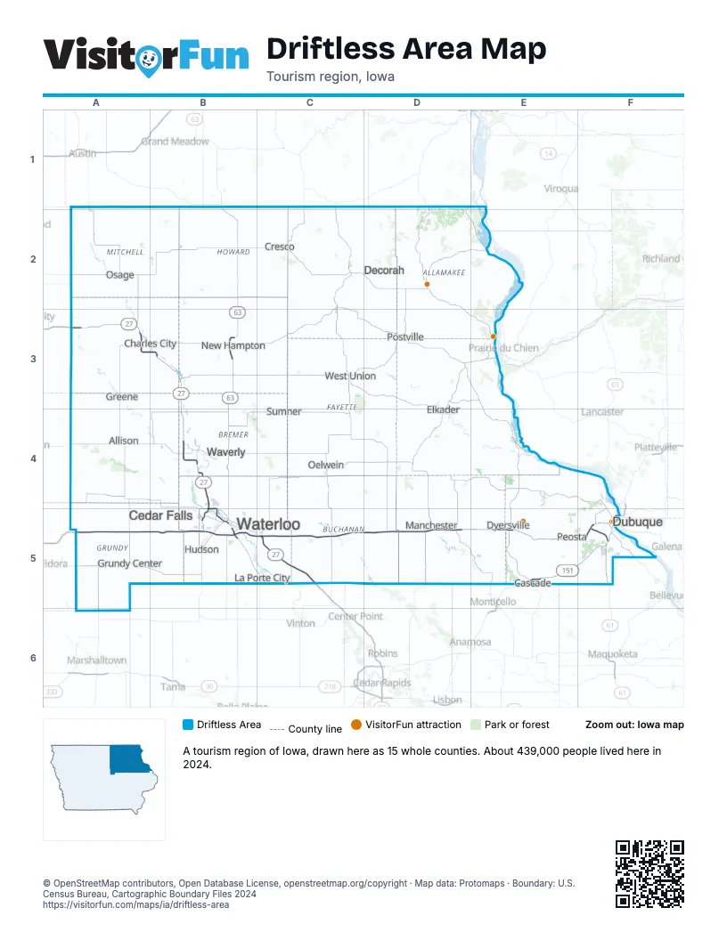
Highway index of Driftless Area
Each highway on the sheet and the grid squares it crosses.
- I-380B5, C5
- US 18A3, B3
- US 20A5, B5, C5, D5, E5, F5
- US 52E5, F5
- US 61F5
- US 63B1, B2, B3, B4, B5
- US 151E5, F5
- US 218A3, B3, B4, B5
- IA 13D5
- IA 27A3, B3, B4, B5, C5
- IA 57B5
- IA 58B5
Things to do on the Driftless Area map
- Cedar Rock State Park
- Dubuque Arboretum and Botanical Gardens
- Dubuque Museum of Art
- Effigy Mounds National Monument
- Fenelon Place Elevator
- Field of Dreams Movie Site
- Mines of Spain State Recreation Area and E. B. Lyons Nature Center
- National Mississippi River Museum & Aquarium
- Pikes Peak State Park
- Vesterheim Norwegian-American Museum
Places on the map
- Allison
- Cascade
- Cedar Falls
- Charles City
- Cresco
- Decorah
- Dubuque
- Dyersville
- Elkader
- Greene
- Grundy Center
- Hudson
- La Porte City
- Manchester
- New Hampton
- Oelwein
- Osage
- Peosta
- Postville
- Sumner
- Waterloo
- Waverly
- West Union
Next to Driftless Area
- Capital Country map
- Lakes and Land map
- Storied and Scenic map
- Great Rivers Country
- Southern Minnesota
- Southwest Wisconsin
© OpenStreetMap contributors, Open Database License, openstreetmap.org/copyright · Map data: Protomaps · Boundary: U.S. Census Bureau, Cartographic Boundary Files 2024