

Illinois map
Trails to Adventure map
The sheet's index lists 20 highways; I-57, I-64 and US 50 cross the most grid squares. Things to do inside the boundary: Cache River State Natural Area, Cave-in-Rock State Park and Fort Defiance State Park. Also on it: Albion, Anna and Benton.
Open the map (PDF, US Letter)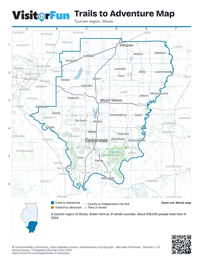
Highway index of Trails to Adventure
Each highway on the sheet and the grid squares it crosses.
- I-24C5, D5, D6
- I-57C2, C3, C4, C5, C6, D1, D2
- I-64B2, B3, C3, D3, E3
- I-70B2, C1, C2, D1
- US 40B2, C1
- US 45C5, D2, D4, D5
- US 50B2, C2, D2, E2, F2
- US 51C1, C2, C4, C5, C6
- US 60C6
- US 62C6
- IL 3A3, B4, B5, C5, C6
- IL 13C4, D4, E4
- IL 34D4
- KY 56E4
- IL 127C2, C3, C4, C5
- IL 141D4, E4
- IL 146B5, C5
- IL 149B4, C4
- IL 185C1
- IL 250E2
Things to do on the Trails to Adventure map
Places on the map
- Albion
- Anna
- Benton
- Breese
- Carbondale
- Carmi
- Centralia
- Chester
- Du Quoin
- Effingham
- Eldorado
- Flora
- Greenville
- Harrisburg
- Herrin
- Lawrenceville
- Louisville
- McLeansboro
- Metropolis
- Mount Carmel
- Mount Vernon
- Nashville
- Newton
- Olney
- Red Bud
- Robinson
- Salem
- Shawneetown
- Sparta
- Vandalia
- Vienna
Next to Trails to Adventure
- Great Rivers Country map
- Land of Lincoln map
- Southwest Indiana
- Green River
- Western Lakes and Rivers
- Southeast Missouri
© OpenStreetMap contributors, Open Database License, openstreetmap.org/copyright · Map data: Protomaps · Boundary: U.S. Census Bureau, Cartographic Boundary Files 2024