

Illinois map
Great Rivers Country map
The sheet's index lists 26 highways; IL 110, I-55 and I-70 cross the most grid squares. Things to do inside the boundary: Alton National Cemetery, Apple River Canyon State Park and Cahokia Mounds State Historic Site. Also on it: Aledo, Alton and Belleville.
Open the map (PDF, US Letter)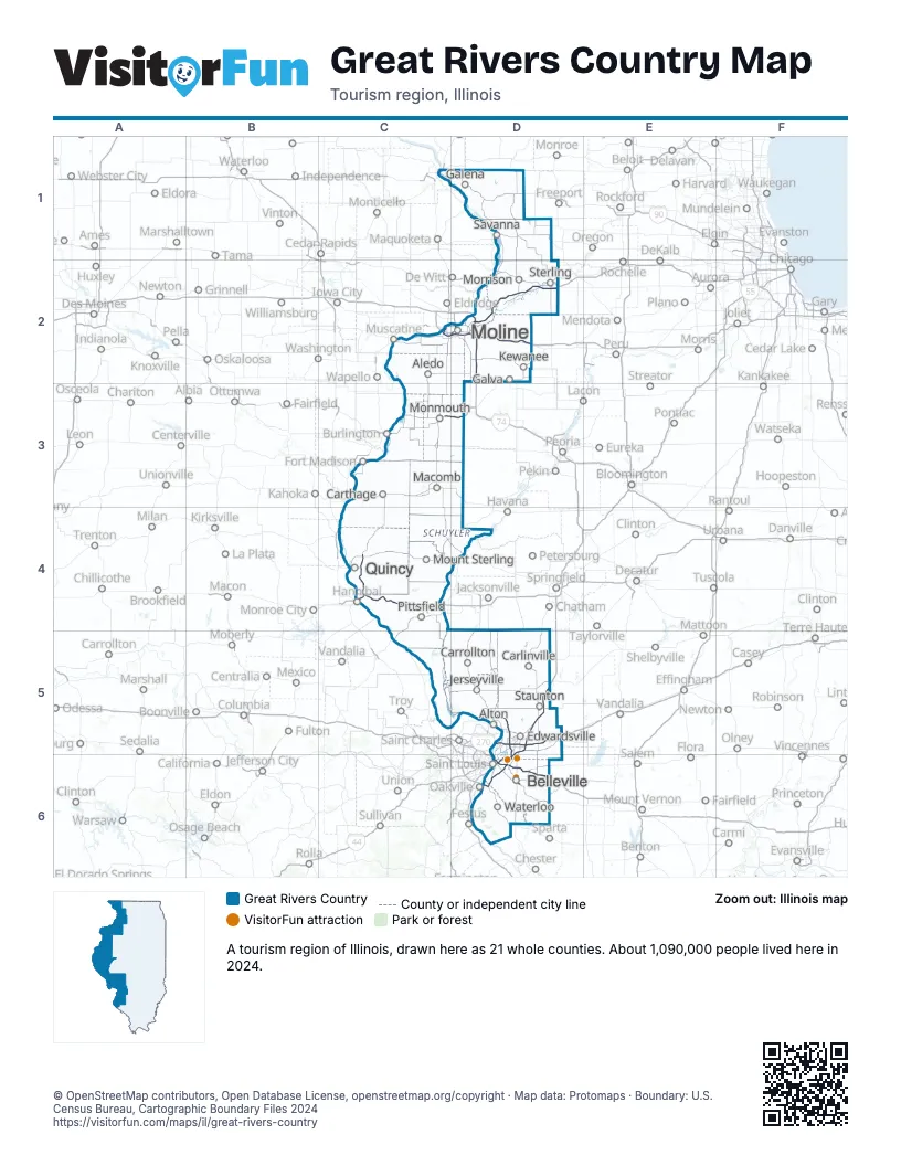
Highway index of Great Rivers Country
Each highway on the sheet and the grid squares it crosses.
- I-55D5, D6
- I-64D6
- I-70D5, D6
- I-72C4
- I-74D2
- I-80D2
- I-88D2
- I-172C4
- I-255D5, D6
- I-270D5
- I-280C2, D2
- US 6D2
- US 34C3, D3
- US 36C4
- US 40D5, D6
- US 50D6
- US 66D5
- US 67D5
- IL 3D6
- IL 5D2
- IL 15D6
- IL 92C2, D2
- IL 110C3, C4, D2, D3
- IA 163C3
- IL 255D5
- IL 336C4
Things to do on the Great Rivers Country map
- Alton National Cemetery
- Apple River Canyon State Park
- Cahokia Mounds State Historic Site
- Carthage Jail
- Downstate Illinois
- Galena Historic District
- John Deere Pavilion
- John Hauberg Museum of Native American Life
- Mississippi Palisades State Park
- New Philadelphia National Historic Site
- Pere Marquette State Park
- Western Illinois Museum
- World's Largest Catsup Bottle
Places on the map
- Aledo
- Alton
- Belleville
- Carlinville
- Carrollton
- Carthage
- Edwardsville
- Galena
- Galva
- Jerseyville
- Kewanee
- Macomb
- Moline
- Monmouth
- Morrison
- Mount Sterling
- Pittsfield
- Quincy
- Savanna
- Staunton
- Sterling
- Waterloo
Next to Great Rivers Country
- Driftless Area
- Storied and Scenic
- Chicago & Beyond map
- Land of Lincoln map
- Trails to Adventure map
- Northeast Missouri
- Southeast Missouri
- Southwest Wisconsin
© OpenStreetMap contributors, Open Database License, openstreetmap.org/copyright · Map data: Protomaps · Boundary: U.S. Census Bureau, Cartographic Boundary Files 2024