

Indiana road map
I-74 in Indiana map
I-74 is about 169 miles in Indiana. It has 46 exits, from Exit 8 at mile 8 to Exit 169 at mile 167. It meets 28 highways; US 136, I-465 and US 36 meet it in the most grid squares.
Open the map (PDF, US Letter)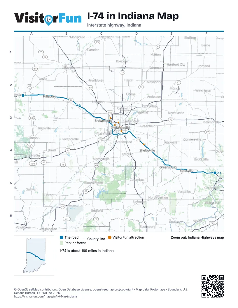
Exits on I-74 in Indiana
Each exit in mile order, with its grid square.
- Exit 8mile 8, A2
- Exit 15mile 16, A2
- Exit 25mile 24, B2
- Exit 34mile 33, B2
- Exit 39mile 39, B3
- Exit 52mile 52, C3
- Exit 58mile 57, C3
- Exit 61mile 61, C3
- Exit 66mile 65, C3
- Exit 68mile 68, C3
- Exit 73mile 72, C3
- Exit 16Bmile 73, C3
- Exit 16Amile 73, C3
- Exit 14mile 74, C3
- Exit 13mile 75, C3
- Exit 12mile 76, C3
- Exit 11mile 77, C3
- Exit 9A-Bmile 78, C3
- Exit 73Bmile 79, C3
- Exit 9mile 79, C3
- Exit 7mile 81, C4
- Exit 5mile 82, C4
- Exit 4mile 83, C4
- Exit 2Bmile 86, D4
- Exit 2Amile 86, D4
- Exit 53Bmile 88, D3
- Exit 53Amile 88, D3
- Exit 49mile 92, D3
- Exit 94mile 92, D3
- Exit 96mile 94, D3
- Exit 99mile 98, D4
- Exit 101mile 99, D4
- Exit 103mile 102, D4
- Exit 109mile 107, D4
- Exit 113mile 111, D4
- Exit 116mile 114, D4
- Exit 119mile 117, D4
- Exit 123mile 121, E4
- Exit 132mile 130, E4
- Exit 134Amile 132, E4
- Exit 134Bmile 132, E4
- Exit 143mile 141, E5
- Exit 149mile 147, E5
- Exit 156mile 153, F5
- Exit 164mile 161, F5
- Exit 169mile 167, F5
Highways I-74 meets
Each highway it meets and the grid squares where they meet.
- IN 63A2
- US 136A2, C3
- US 41A2
- IN 341B2
- IN 47B2
- IN 75C3
- IN 39C3
- IN 267C3
- I-465C3, C4
- US 36C3, C4
- US 40C3, C4
- I-70C3
- IN 67C4
- IN 37C4
- IN 135D4
- US 31D4
- I-65D3
- US 421D4
- IN 9D4
- IN 44D4
- IN 244D4
- IN 3E4
- IN 46E5
- IN 229E5
- IN 101F5
- IN 1F5
- US 50F5
- US 52F5
Towns along I-74 in Indiana
In mile order, with the grid square of each.
- Fostermile 3, A2
- Covingtonmile 7, A2
- Veedersburgmile 14, A2
- Hillsboromile 20, B2
- Waynetownmile 25, B2
- Crawfordsvillemile 34, B2
- Jamestownmile 51, C3
- Liztonmile 57, C3
- Pittsboromile 61, C3
- Brownsburgmile 63, C3
- Indianapolis city (balance)mile 69, C3
- Clermontmile 70, C3
- Speedwaymile 73, C3
- Beech Grovemile 88, D3
- Pleasant Viewmile 99, D4
- Londonmile 102, D4
- Fairlandmile 106, D4
- Shelbyvillemile 108, D4
- Waldronmile 120, E4
- St. Omermile 123, E4
- Adamsmile 128, E4
- Greensburgmile 128, E4
- Batesvillemile 145, E5
- Penntownmile 154, F5
- St. Leonmile 159, F5
- Brightmile 166, F5
Things to do on the I-74 in Indiana map
© OpenStreetMap contributors, Open Database License, openstreetmap.org/copyright · Map data: Protomaps · Boundary: U.S. Census Bureau, TIGER/Line 2026















