

Indiana road map
Whitewater Canal Scenic Byway map
The Whitewater Canal Scenic Byway has been a National Scenic Byway since 2021, named for its historic qualities: about 188 miles in Indiana. It meets 20 highways, among them I-70, I-74 and I-275. Towns along it: Richmond, Connersville and Lawrenceburg.
Open the map (PDF, US Letter)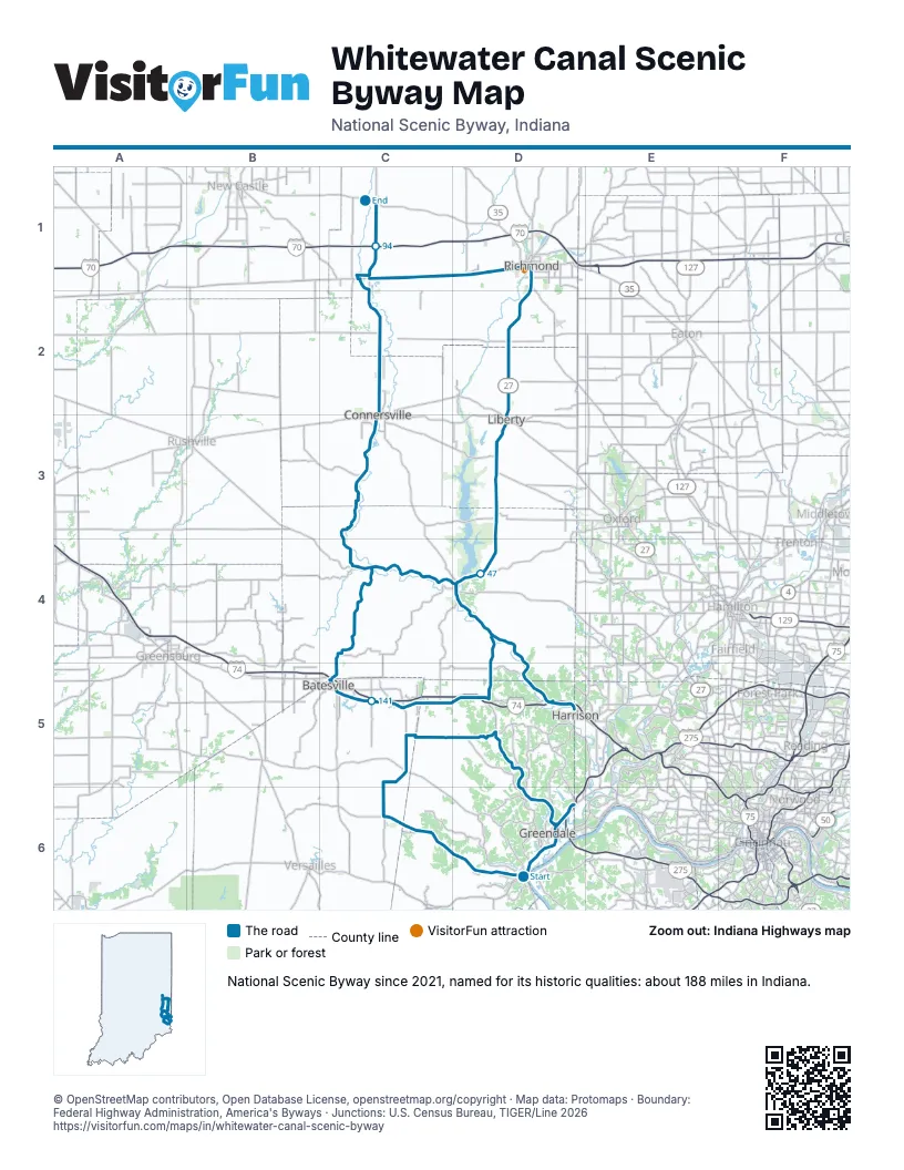
Highways it meets
Each highway it meets and the grid squares where they meet.
- US 50D6
- IN 148D6
- IN 350D6
- IN 101C6
- IN 48C5
- IN 46C5
- I-74D5
- IN 1D5
- US 52D4
- IN 252D4
- US 27D3
- IN 44D3
- IN 227D1
- US 40D1
- IN 38C1
- I-70C1
- IN 121C3
- IN 229C4
- IN 129C5
- I-275D6
Towns along the Whitewater Canal Scenic Byway
In mile order, with the grid square of each.
- Auroramile 0, D6
- Milanmile 14, C6
- Sunmanmile 22, C5
- Penntownmile 25, C5
- St. Leonmile 31, D5
- Cedar Grovemile 38, D4
- Brookvillemile 43, D4
- Libertymile 62, D3
- Richmondmile 74, D2
- Centervillemile 81, D1
- East Germantownmile 89, C1
- Hagerstownmile 89, C1
- Cambridge Citymile 97, C1
- Miltonmile 99, C2
- Connersvillemile 105, C2
- Metamoramile 126, C4
- Peppertownmile 129, C4
- Oldenburgmile 134, C4
- Batesvillemile 136, C5
- Morrismile 140, C5
- Hidden Valleymile 162, D6
- Greendalemile 162, D6
- Lawrenceburgmile 165, D6
- West Harrisonmile 171, D5
- Brightmile 172, D5
- New Trentonmile 176, D5
Things to do on the Whitewater Canal Scenic Byway map
© OpenStreetMap contributors, Open Database License, openstreetmap.org/copyright · Map data: Protomaps · Boundary: Federal Highway Administration, America's Byways · Junctions: U.S. Census Bureau, TIGER/Line 2026















