

Kansas road map
Kansas highway map
9 Interstate routes run about 859 miles in Kansas, each on a sheet of its own. The sheet's index lists 33 highways; I-70, I-35 and US 40 cross the most grid squares. Towns on it: Wichita, Overland Park and Topeka.
Open the map (PDF, US Letter)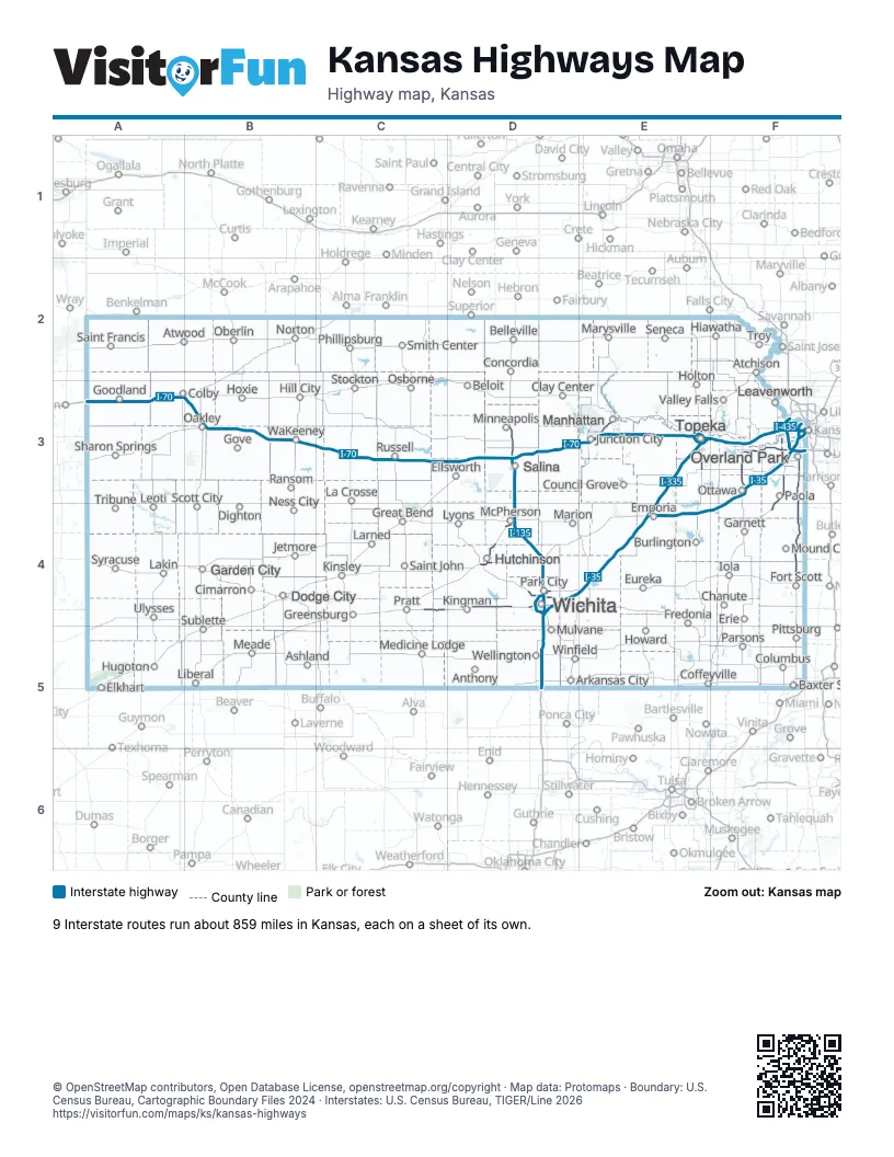
Road maps of Kansas
10 road maps: each Interstate and byway on a sheet of its own.
Highway index of Kansas
Each highway on the sheet and the grid squares it crosses.
- I-35D4, D5, E4, F3, F4
- I-70A3, B3, C3, D3, E3, F3
- I-135D3, D4
- I-235D4
- I-335E3, E4
- I-435F3
- I-470E3, F3
- I-635F3
- I-670F3
- US 24A3, E3, F3
- US 36F2
- US 40B3, C3, D3, E3, F3
- US 50D4, E4, F3, F4
- US 54C4, D4, E4, F4
- US 56F3
- US 59F3
- US 69F3, F4
- US 75E3
- US 77D4, E4
- US 81D3, D4
- US 166F5
- US 169F3, F4
- US 400C4, D4, E4, F5
- KS 4D3, E3, F3
- KS 5F3
- KS 14D3, D4
- KS 15D4
- KS 18E3
- KS 31E4, F4
- KS 52F4
- KS 61D4
- KS 96D4
- KS 254D4
Places on the map
- Anthony
- Arkansas City
- Ashland
- Atchison
- Atwood
- Baxter Springs
- Belleville
- Beloit
- Burlington
- Chanute
- Cimarron
- Clay Center
- Coffeyville
- Colby
- Columbus
- Concordia
- Council Grove
- Dighton
- Dodge City
- Elkhart
- Ellsworth
- Emporia
- Erie
- Eureka
- Fort Scott
- Fredonia
- Garden City
- Garnett
- Goodland
- Gove
- Great Bend
- Greensburg
- Hiawatha
- Hill City
- Holton
- Howard
- Hoxie
- Hugoton
- Hutchinson
- Iola
- Jetmore
- Junction City
- Kingman
- Kinsley
- La Crosse
- Lakin
- Larned
- Leavenworth
- Leoti
- Liberal
- Lyons
- Manhattan
- Marion
- Marysville
- McPherson
- Meade
- Medicine Lodge
- Minneapolis
- Mound City
- Mulvane
- Ness City
- Norton
- Oakley
- Oberlin
- Osborne
- Ottawa
- Overland Park
- Paola
- Park City
- Parsons
- Phillipsburg
- Pittsburg
- Pratt
- Ransom
- Russell
- Saint Francis
- Saint John
- Salina
- Scott City
- Seneca
- Sharon Springs
- Smith Center
- Stockton
- Sublette
- Syracuse
- Topeka
- Tribune
- Troy
- Ulysses
- Valley Falls
- WaKeeney
- Wellington
- Wichita
- Winfield
© OpenStreetMap contributors, Open Database License, openstreetmap.org/copyright · Map data: Protomaps · Boundary: U.S. Census Bureau, Cartographic Boundary Files 2024 · Interstates: U.S. Census Bureau, TIGER/Line 2026















