

Kentucky map
Eastern Highlands-South map
The sheet's index lists 31 highways; I-75, US 119 and KY 15 cross the most grid squares. Things to do inside the boundary: Cumberland Falls State Resort Park, Cumberland Gap National Historical Park and Harland Sanders Café and Museum. Also on it: Barbourville, Beattyville and Corbin.
Open the map (PDF, US Letter)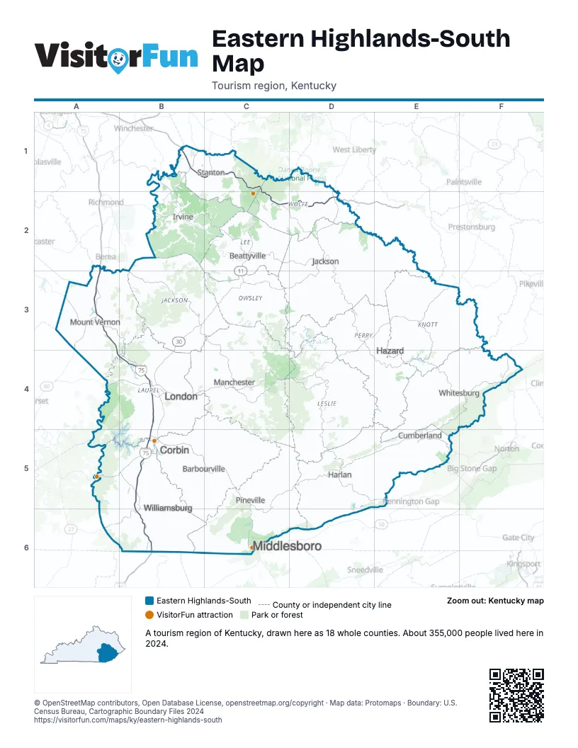
Highway index of Eastern Highlands-South
Each highway on the sheet and the grid squares it crosses.
- I-75A2, A3, A4, B4, B5, B6
- US 23F4
- US 25A3
- US 25EB5, C5, C6
- US 25WB5
- US 119C5, C6, D5, E4, E5, F4
- US 150A3
- US 421D5, E5
- KY 7E4
- KY 11C1, C2, C3, C5
- KY 15C2, D2, D3, D4, E4, F4
- KY 30B3, B4, C3, D2
- SR 32C6
- KY 52C2
- KY 72D5
- KY 80A4, B4, D3, E3
- KY 92A6, B6
- KY 160E4
- KY 191D1, D2
- KY 192B4
- KY 205D1, D2
- KY 267D3
- KY 461A3
- KY 931E4
- KY 987C5
- KY 1146E3
- KY 1431B3
- KY 1812D2
- KY 3041B5
- KY 3085C5
- KY 3150C2
Things to do on the Eastern Highlands-South map
Places on the map
- Barbourville
- Beattyville
- Corbin
- Cumberland
- Harlan
- Hazard
- Irvine
- Jackson
- London
- Manchester
- Middlesboro
- Mount Vernon
- Pineville
- Stanton
- Whitesburg
- Williamsburg
Next to Eastern Highlands-South
- Bluegrass map
- Eastern Highlands-North map
- Southern Kentucky Lakes and Rivers map
- East Tennessee
- Southwest Virginia - Heart of Appalachia
© OpenStreetMap contributors, Open Database License, openstreetmap.org/copyright · Map data: Protomaps · Boundary: U.S. Census Bureau, Cartographic Boundary Files 2024