

Kentucky road map
I-265 in Kentucky map
I-265 is about 27 miles in Kentucky. It has 19 exits, from Exit 10A at mile 0 to Exit 37 at mile 25. It meets 13 highways; KY 841, KY 61 and KY 864 meet it in the most grid squares.
Open the map (PDF, US Letter)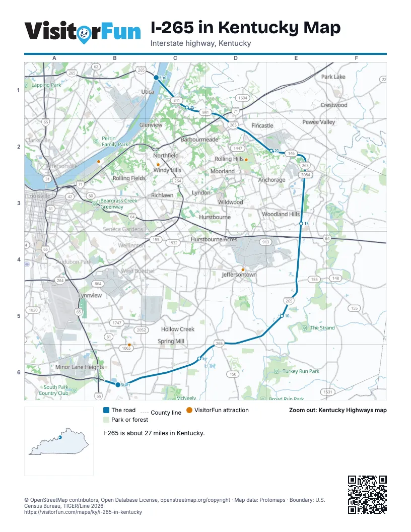
Exits on I-265 in Kentucky
Each exit in mile order, with its grid square.
- Exit 10Amile 0, B6
- Exit 12mile 1, B6
- Exit 14mile 2, C6
- Exit 15mile 5, C6
- Exit 17mile 6, D6
- Exit 19mile 8, D5
- Exit 23mile 12, E4
- Exit 25Amile 14, E4
- Exit 19Amile 14, E4
- Exit 25Bmile 15, E3
- Exit 27mile 16, E3
- Exit 29mile 17, E3
- Exit 30mile 19, E2
- Exit 32mile 22, D2
- Exit 34mile 23, D2
- Exit 9Bmile 23, D2
- Exit 35Amile 23, D2
- Exit 35Bmile 24, C1
- Exit 37mile 25, C1
Highways I-265 meets
Each highway it meets and the grid squares where they meet.
- KY 841B6, E2, E4
- KY 61B6
- KY 864C6
- US 31ED6
- US 150D6
- KY 155E4
- I-64E4
- US 60E3
- KY 146E2
- KY 1447D2
- I-71D2
- KY 22D2
- US 42C1
Towns along I-265 in Kentucky
In mile order, with the grid square of each.
- Louisville/Jefferson County metro government (balance)mile 0, B6
- Middletownmile 14, E4
- Anchoragemile 18, E2
- Fincastlemile 21, D2
- Creeksidemile 22, D2
- Ten Broeckmile 22, D2
- Manor Creekmile 23, D2
- Brownsboro Farmmile 23, D2
- Barbourmeademile 24, C1
- Prospectmile 25, C1
© OpenStreetMap contributors, Open Database License, openstreetmap.org/copyright · Map data: Protomaps · Boundary: U.S. Census Bureau, TIGER/Line 2026