

Kentucky road map
Kentucky highway map
10 Interstate routes run about 897 miles in Kentucky, each on a sheet of its own. The sheet's index lists 33 highways; I-75, I-64 and I-65 cross the most grid squares. Towns on it: Bowling Green, Owensboro and Covington.
Open the map (PDF, US Letter)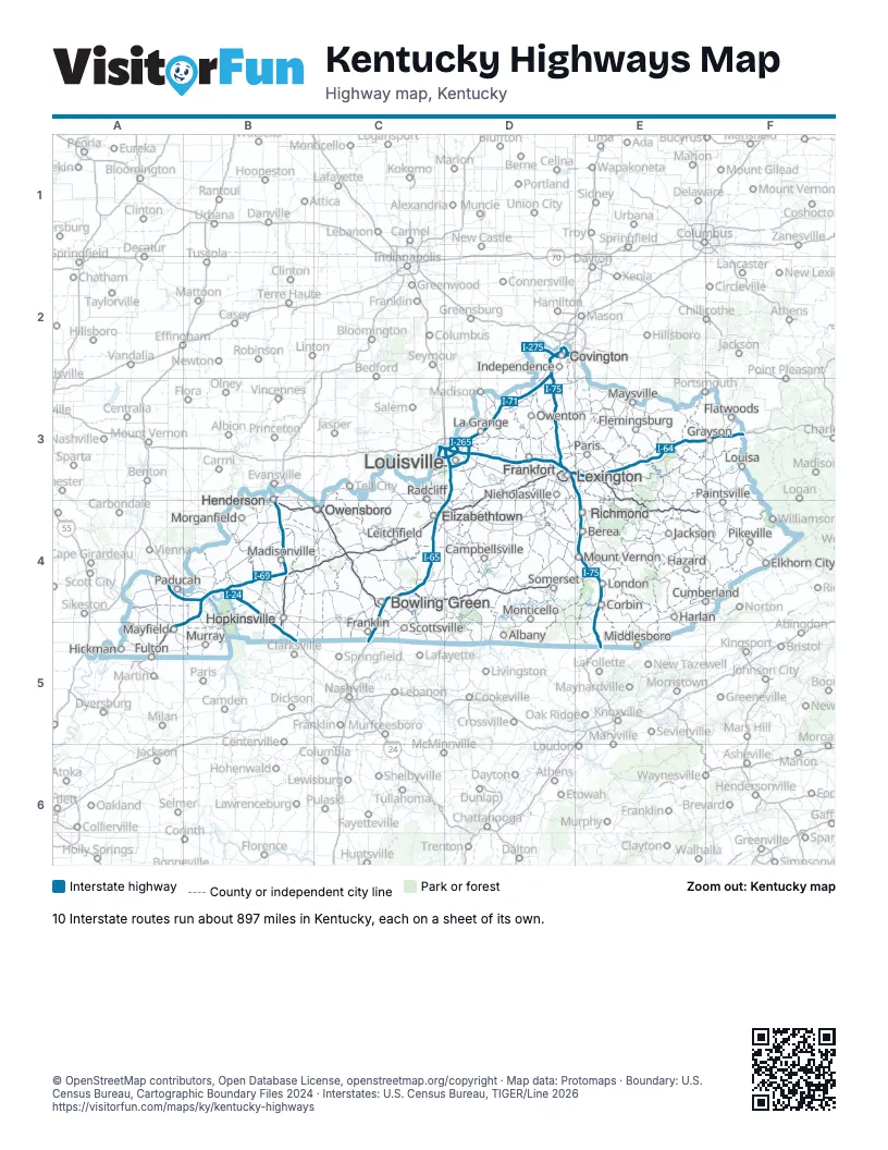
Road maps of Kentucky
13 road maps: each Interstate and byway on a sheet of its own.
Highway index of Kentucky
Each highway on the sheet and the grid squares it crosses.
- I-24A4, B4, B5
- I-64C3, D3, E3, F3
- I-65C4, C5, D3, D4
- I-69A5, B3, B4, B5
- I-71D2, D3
- I-75D2, D3, E3, E4, E5
- I-165C4
- I-169B4, B5
- I-264C3, D3
- I-265D3
- I-275D2
- I-471D2
- US 23F4
- US 25E3
- US 31ED4
- US 41B3, B4
- US 45A5
- US 51A5
- US 52F3
- US 60B4, C4
- US 119F4
- US 150C3
- US 231C4
- US 421E3
- US 460F4
- KY 4D3
- KY 80A5, F4
- KY 841C3, D3
- KY 1426F4
- KY 1934C3
- KY 3145C4
- KY 3690B3
- KY 9007C4
Places on the map
- Albany
- Berea
- Bowling Green
- Campbellsville
- Corbin
- Covington
- Cumberland
- Elizabethtown
- Elkhorn City
- Flatwoods
- Flemingsburg
- Frankfort
- Franklin
- Fulton
- Grayson
- Harlan
- Hazard
- Henderson
- Hickman
- Hopkinsville
- Independence
- Jackson
- La Grange
- Leitchfield
- Lexington
- London
- Louisa
- Louisville
- Madisonville
- Mayfield
- Maysville
- Middlesboro
- Monticello
- Morganfield
- Mount Vernon
- Murray
- Nicholasville
- Owensboro
- Owenton
- Paducah
- Paintsville
- Paris
- Pikeville
- Radcliff
- Richmond
- Scottsville
- Somerset
© OpenStreetMap contributors, Open Database License, openstreetmap.org/copyright · Map data: Protomaps · Boundary: U.S. Census Bureau, Cartographic Boundary Files 2024 · Interstates: U.S. Census Bureau, TIGER/Line 2026