

Kentucky map
Western Lakes and Rivers map
The sheet's index lists 17 highways; I-24, I-69 and KY 80 cross the most grid squares. Things to do inside the boundary: Jefferson Davis State Historic Site, Lake Barkley State Resort Park and National Quilt Museum. Also on it: Benton, Cadiz and Fort Campbell North.
Open the map (PDF, US Letter)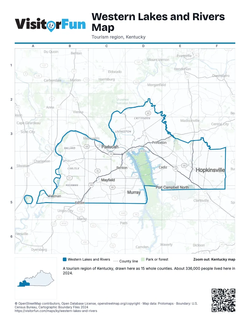
Highway index of Western Lakes and Rivers
Each highway on the sheet and the grid squares it crosses.
- I-24C3, C4, D3, D4, E4, E5, F5
- I-69B5, C4, C5, D3, D4, E3
- I-169E3, E4
- US 41E4, E5
- US 45C3, C4
- US 51B4, B5
- US 60B3, B4, C3, D2, D3
- US 62B4, C3, C4
- US 68C4, D4, E4, F4
- US 641C4, C5, D4, D5
- KY 80C4, C5, D4, D5, E4, F4
- KY 91D3
- KY 121C4, C5
- KY 133D3
- KY 924B5
- KY 1286C3
- KY 1682E4
Things to do on the Western Lakes and Rivers map
Places on the map
- Benton
- Cadiz
- Fort Campbell North
- Fulton
- Hickman
- Hopkinsville
- Mayfield
- Murray
- Paducah
- Princeton
Next to Western Lakes and Rivers
- Trails to Adventure
- Cave Region map
- Green River map
- Southeast Missouri
- Middle Tennessee
- West Tennessee
© OpenStreetMap contributors, Open Database License, openstreetmap.org/copyright · Map data: Protomaps · Boundary: U.S. Census Bureau, Cartographic Boundary Files 2024