

Louisiana road map
Boom or Bust Byway map
The Boom or Bust Byway has been a National Scenic Byway since 2021, named for its historic qualities: about 133 miles in Louisiana. It meets 28 highways, among them I-49, US 71 and US 79. Towns along it: Blanchard, Vivian and Homer.
Open the map (PDF, US Letter)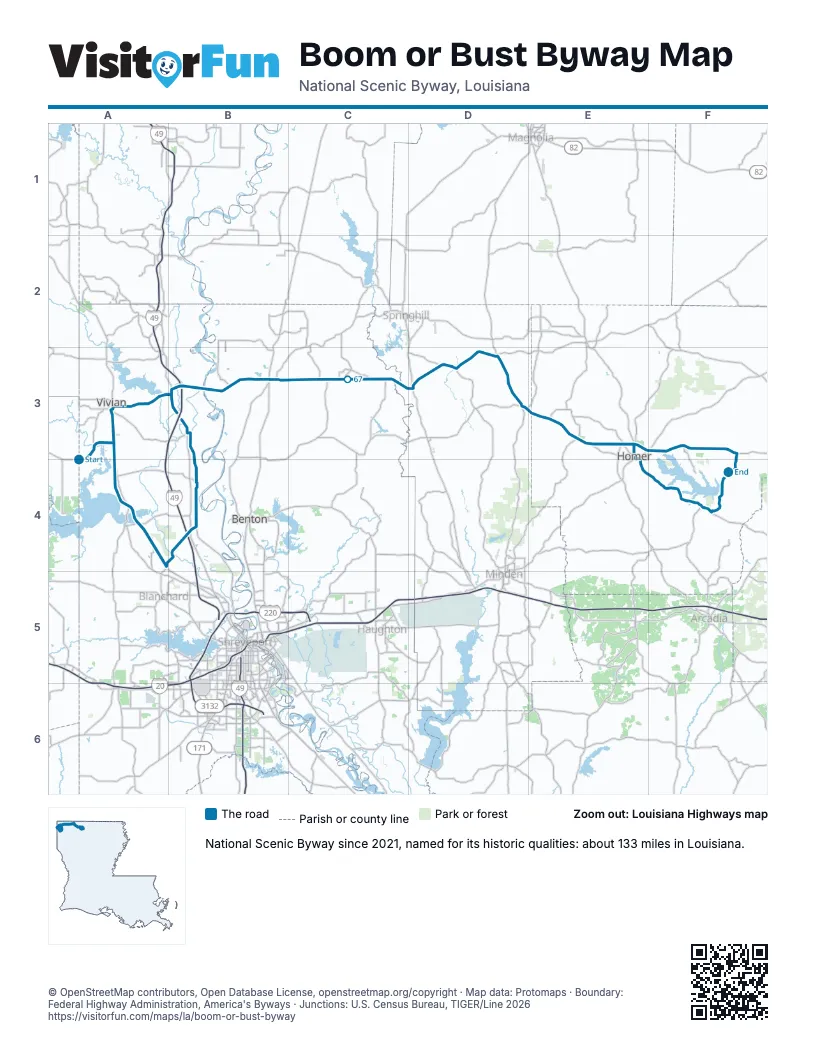
Highways it meets
Each highway it meets and the grid squares where they meet.
- LA 2A4
- LA 170A3
- LA 1A3
- LA 538A4
- LA 530A4
- LA 169A4
- LA 173B4
- I-49B4
- US 71B4
- LA 3049B4
- LA 537B3
- LA 3B3
- LA 157B3
- LA 529C3
- US 371D3
- LA 7D3
- LA 802D3
- LA 159D3
- LA 160D3
- LA 521D3
- LA 534E3
- LA 3062E3
- LA 9E3
- LA 540E3
- US 79E3
- LA 146E4
- LA 518F4
- LA 806F3
Towns along the Boom or Bust Byway
In mile order, with the grid square of each.
- Hosstonmile 4, A3
- Vivianmile 9, A3
- Oil Citymile 17, A4
- Mooringsportmile 22, A4
- Blanchardmile 27, A4
- Belchermile 36, B4
- Gilliammile 41, B3
- Plain Dealingmile 58, B3
- Sareptamile 74, D3
- Shongaloomile 84, D3
- Homermile 103, E3
- Lisbonmile 119, F4
© OpenStreetMap contributors, Open Database License, openstreetmap.org/copyright · Map data: Protomaps · Boundary: Federal Highway Administration, America's Byways · Junctions: U.S. Census Bureau, TIGER/Line 2026















