

Louisiana road map
Louisiana highway map
12 Interstate routes run about 913 miles in Louisiana, each on a sheet of its own. The sheet's index lists 28 highways; I-10, I-20 and I-49 cross the most grid squares. Towns on it: New Orleans, Baton Rouge and Shreveport.
Open the map (PDF, US Letter)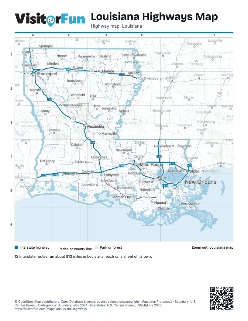
Road maps of Louisiana
15 road maps: each Interstate and byway on a sheet of its own.
Highway index of Louisiana
Each highway on the sheet and the grid squares it crosses.
- I-10A5, B4, B5, C4, D4, D5, E4, E5
- I-12D4, E4
- I-20A1, A2, B1, C1, C2, D2
- I-49A1, A2, B2, B3, C3, C4
- I-55D4, E4, E5
- I-59E4
- I-110D4
- I-210B4, B5
- I-220A1, A2
- I-310E5
- I-510E5
- I-610E5
- US 11E4
- US 51D4, E4, E5
- US 61D4
- US 71A1, B3
- US 80D2
- US 90A5, B4, C5, D5, E5
- US 165B3
- US 167B3, C4
- US 190D4, E4
- US 371A1, B1
- LA 8B3
- LA 28B3
- LA 47E5
- LA 182C4
- LA 3132A2
- LA 3139E5
Places on the map
- Abbeville
- Alexandria
- Bastrop
- Baton Rouge
- Blanchard
- Bogalusa
- Central
- Chauvin
- Clinton
- Crowley
- DeQuincy
- Eunice
- Farmerville
- Franklinton
- Gonzales
- Homer
- Houma
- Jeanerette
- Jena
- Jennings
- Jonesboro
- Jonesville
- Lafayette
- Lake Providence
- LaPlace
- Leesville
- Lutcher
- Mandeville
- Mansfield
- Many
- Marksville
- Minden
- Monroe
- Morgan City
- Natchitoches
- New Iberia
- New Orleans
- New Roads
- Oakdale
- Olla
- Opelousas
- Port Sulphur
- Ruston
- Shreveport
- Slidell
- Springhill
- Tallulah
- Thibodaux
- Vidalia
- Vivian
- Winnfield
- Winnsboro
© OpenStreetMap contributors, Open Database License, openstreetmap.org/copyright · Map data: Protomaps · Boundary: U.S. Census Bureau, Cartographic Boundary Files 2024 · Interstates: U.S. Census Bureau, TIGER/Line 2026















