

Louisiana map
St. Tammany Parish map
About 277,615 people live here (Census Bureau, 2024 estimate). The sheet's index lists 4 streets; West Florida Republic Parkway, Frank Davis "Naturally N'Awlins" Memorial Bridge and North Causeway Boulevard cross the most grid squares. Things to do inside the boundary: Honey Island Swamp Tour, Lake Pontchartrain Causeway and Lodge Cast Iron Factory Store.
Open the map (PDF, US Letter)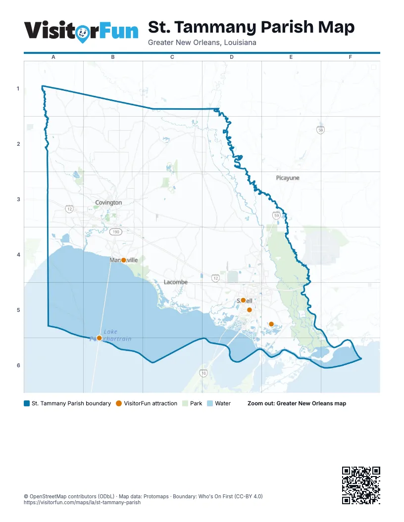
Street index of St. Tammany Parish
Each street on the sheet and the grid squares it crosses.
- West Florida Republic ParkwayA3, B3, B4, C4, D4, D5, E5
- North Causeway BoulevardB4
- Frank Davis "Naturally N'Awlins" Memorial BridgeD5, D6
- Stephen E Ambrose Memorial ParkwayE5
Things to do on the St. Tammany Parish map
Places on the map
- Abita Creek Flatwoods Preserve
- Abita Springs
- Abita Springs Golf Club
- Bayou Bonfouca
- Bayou Des Mats
- Bayou Lacombe
- Bayou Laurier
- Camp Salmen Nature Park
- Camp Villere
- Covington
- Cowpen Bay
- Cross Gates Boulevard
- Devils Swamp
- Eagle Bend Park
- Eden Isle
- Eden Isle Canals
- Fairview-Riverside State Park
- Fawn Bayou
- Folsom
- Fontainebleau State Park
- Fountainbleau State Preserve
- Fremaux Town Center
- Fritchie Marsh
- Geoghegan Canal
- Gum Swamp
- Johnson Island
- Joiner Lake
- Kopman Bayou
- Lacombe
- Lake Pontchartrain
- Lake Ramsay Preserve
- Lake Ramsey
- Lakeshore Boulevard
- Little Lagoon
- Louie Reed Brake
- Lower Black Bayou
- Madisonville
- Mandeville
- Mandeville Lakefront
- Money Hill Golf & Country Club
Next to St. Tammany Parish
- Picayune
© OpenStreetMap contributors (ODbL) · Map data: Protomaps · Boundary: Who's On First (CC-BY 4.0)